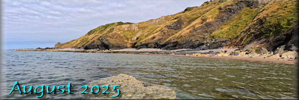
Twenty Five Years
of Island Images - August 2000 - 2024
|
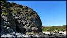
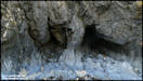
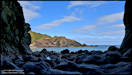
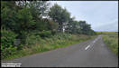
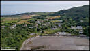
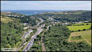
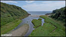
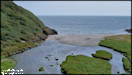
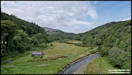
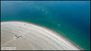
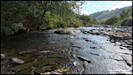
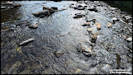
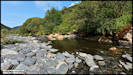
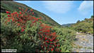
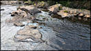
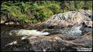
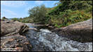
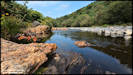
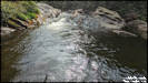
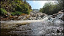
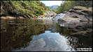
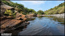
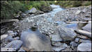
3/8/25
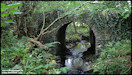
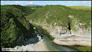
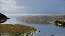
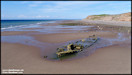
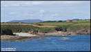
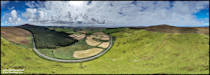
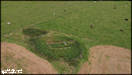
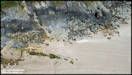
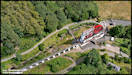
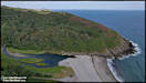
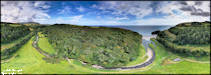
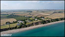
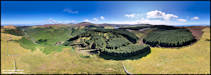
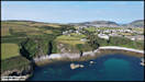
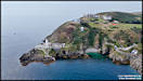
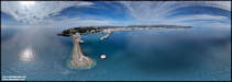
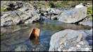
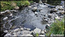
When I was selecting
the pictures for the 'Twenty Five Years - August' section above, I included
one of Santon Gorge from 2004. I realised that I hadn't been there
for a while so on Friday afternoon had a little stroll along there, parking
the car close to Cafe Bar 26 on the south side of Ronaldsway.
Panasonic TZ95
1/8/25
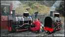
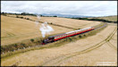
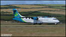
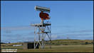
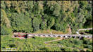
     A few aviation related
pictures. (ATRs and radars!)
A few aviation related
pictures. (ATRs and radars!)
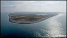
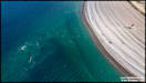
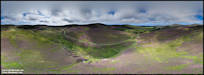
 4/8/25
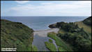
On Saturday morning
I needed to make a trip 'down south' to hopefully retrieve a piece of equipment
that I'd inadvertently left behind when I was at Poyll Vaaish. I'm
pleased to say that it was still there and undamaged, and as the weather
was good for flying I continued to Shore Road Gansey for some aerial photography.
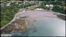
DJI Mini 4 Pro 2/8/25
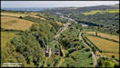
4/8/25
On Saturday morning
I needed to make a trip 'down south' to hopefully retrieve a piece of equipment
that I'd inadvertently left behind when I was at Poyll Vaaish. I'm
pleased to say that it was still there and undamaged, and as the weather
was good for flying I continued to Shore Road Gansey for some aerial photography.
DJI Mini 4 Pro 2/8/25
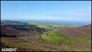
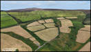
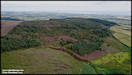
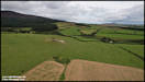
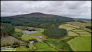
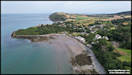
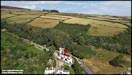
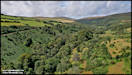
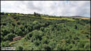
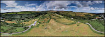
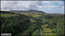
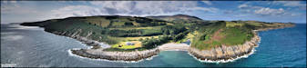
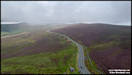
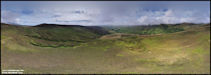
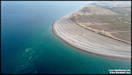
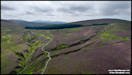
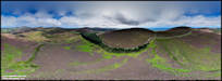
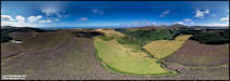
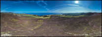
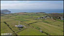
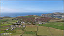
  5/8/25
After my flight down
from the beach on Saturday morning I drove inland to a second site, at
Ronague on the slopes of Slieau Earystane, currently the location of a
controversy as the government has proposed siting four huge wind turbine
on the top of the hill, an area currently hosting trees and heather.
Also close to where I flew is the 'Magnetic Hill' a location where, due
to an optical illusion, a stationary car appears to roll backwards up the
hill!
DJI Mini 4 Pro 2/8/25
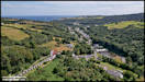
5/8/25
After my flight down
from the beach on Saturday morning I drove inland to a second site, at
Ronague on the slopes of Slieau Earystane, currently the location of a
controversy as the government has proposed siting four huge wind turbine
on the top of the hill, an area currently hosting trees and heather.
Also close to where I flew is the 'Magnetic Hill' a location where, due
to an optical illusion, a stationary car appears to roll backwards up the
hill!
DJI Mini 4 Pro 2/8/25
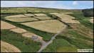    
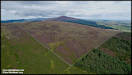
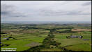
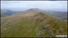
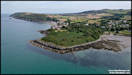
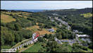
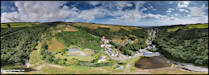
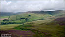
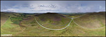
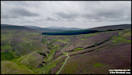
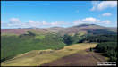
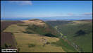
   On the following day
I returned to the Earystane area for some more aerial picture, but this
time flying from the other side of the hill, taking off from the old WW2
RAF Radio Track Beam site. The weather had looked great when I set
off from home, but by the time I was flying a lot of thick cloud had arrived
unfortunately. When I was preparing the pictures I looked up the
Manx Utilities website with information on the proposed wind turbines to
be constructed on the top of the hill and was amazed at how high they would
be. The highest that I am permitted to fly with the drone is 120
metres (c400 feet), but on the larger of the options proposed, the top
of the blades would be at
185 metres (c600 ft)
so 200 feet higher than I was allowed to be! You cane see their webpage
with details here.
DJI Air 2S & Samsung
Galaxy S24 Ultra 3/8/25
On the following day
I returned to the Earystane area for some more aerial picture, but this
time flying from the other side of the hill, taking off from the old WW2
RAF Radio Track Beam site. The weather had looked great when I set
off from home, but by the time I was flying a lot of thick cloud had arrived
unfortunately. When I was preparing the pictures I looked up the
Manx Utilities website with information on the proposed wind turbines to
be constructed on the top of the hill and was amazed at how high they would
be. The highest that I am permitted to fly with the drone is 120
metres (c400 feet), but on the larger of the options proposed, the top
of the blades would be at
185 metres (c600 ft)
so 200 feet higher than I was allowed to be! You cane see their webpage
with details here.
DJI Air 2S & Samsung
Galaxy S24 Ultra 3/8/25
  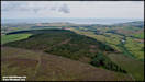 
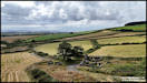
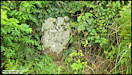
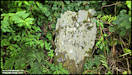
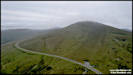
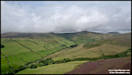
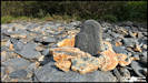
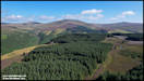
 6/8/25
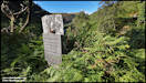
After the flight up
at Slieau Earystane I decided to head down to the 'Magnetic Hill' to see
if I could experience the phenomena. I found the spot and did a bit of
clearing of the undergrowth that was threatening to hide the marker stone.
Some visitors arrived in three vehicles just as I'd taken these pictures
so I headed away for a while before returning to try and get some video
footage of how it works. I just used the dashcam footage from the
car so it's not great quality, but you can view
it here on YouTube.
Samsung Galaxy S24 Ultra
3/8/25
6/8/25
After the flight up
at Slieau Earystane I decided to head down to the 'Magnetic Hill' to see
if I could experience the phenomena. I found the spot and did a bit of
clearing of the undergrowth that was threatening to hide the marker stone.
Some visitors arrived in three vehicles just as I'd taken these pictures
so I headed away for a while before returning to try and get some video
footage of how it works. I just used the dashcam footage from the
car so it's not great quality, but you can view
it here on YouTube.
Samsung Galaxy S24 Ultra
3/8/25
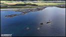
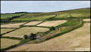
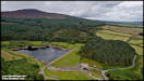
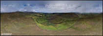
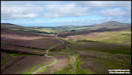
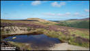
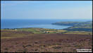
   Whilst I was waiting
for the visitors to have their 'Magnetic Hill Experience' I headed away
a short distance and took a fe aerial shots near Cringle Reservoir.
DJI Air 2S 3/8/25
Whilst I was waiting
for the visitors to have their 'Magnetic Hill Experience' I headed away
a short distance and took a fe aerial shots near Cringle Reservoir.
DJI Air 2S 3/8/25
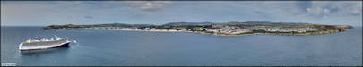
 7/8/25
Yesterday the island
was visited by the cruise ship 'Carnival Miracle' which anchored in Douglas
Bay whilst passengers enjoyed the island, no doubt making a lot of journeys
on the railway systems, including the Horse Tramway, despite the inconvenience
of it not actually going to the Sea Terminal at the moment. I decided
to get a few aerial pictures of her in the bay, then used the rest of the
flight time for some coastal shots, including several picture sets for
stitching into linear panoramas.
DJI Air 2S 6/8/25
7/8/25
Yesterday the island
was visited by the cruise ship 'Carnival Miracle' which anchored in Douglas
Bay whilst passengers enjoyed the island, no doubt making a lot of journeys
on the railway systems, including the Horse Tramway, despite the inconvenience
of it not actually going to the Sea Terminal at the moment. I decided
to get a few aerial pictures of her in the bay, then used the rest of the
flight time for some coastal shots, including several picture sets for
stitching into linear panoramas.
DJI Air 2S 6/8/25
 
 8/8/25
After my Wednesday morning
flight over Douglas Bay I went out again in the afternoon and flew from
two more locations. As you can see from the pictures, the weather
had changed and wasn't great at the first one, Clagh Ouyr, being a bit
dull and overcast with some low cloud drifting past the summit of Snaefell.
I was keen to do some more flying though, as I'd noticed that I was approaching
a milestone in my total number of drone flying hours, but more about that
in the next set of pictures!
DJI Air 2S 6/8/25
8/8/25
After my Wednesday morning
flight over Douglas Bay I went out again in the afternoon and flew from
two more locations. As you can see from the pictures, the weather
had changed and wasn't great at the first one, Clagh Ouyr, being a bit
dull and overcast with some low cloud drifting past the summit of Snaefell.
I was keen to do some more flying though, as I'd noticed that I was approaching
a milestone in my total number of drone flying hours, but more about that
in the next set of pictures!
DJI Air 2S 6/8/25
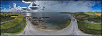
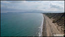
  9/8/25
My third flying location
on Wednesday was Port Lewaigue, just south of Ramsey. I was hoping
for a bit brighter conditions after all of the cloud up in the mountains
and it was indeed a bit better if still overcast. Just as I was finishing
the flight the sun came out, so a quick battery change and off up into
the air again! The milestone in my drone flying I'd mentioned was
passing the 400 hours mark, not a huge number in ten plus years compared
to full sized aircraft, but it had taken me 1,680 actual flights to reach
that number, which averages out to fourteen and a half minutes per flight,
which seems about right for me.
DJI Air 2S 6/8/25
9/8/25
My third flying location
on Wednesday was Port Lewaigue, just south of Ramsey. I was hoping
for a bit brighter conditions after all of the cloud up in the mountains
and it was indeed a bit better if still overcast. Just as I was finishing
the flight the sun came out, so a quick battery change and off up into
the air again! The milestone in my drone flying I'd mentioned was
passing the 400 hours mark, not a huge number in ten plus years compared
to full sized aircraft, but it had taken me 1,680 actual flights to reach
that number, which averages out to fourteen and a half minutes per flight,
which seems about right for me.
DJI Air 2S 6/8/25
 10/8/25
Between the first and
second flights at Port Lewaigue I had changed over the phone used as a
display with the controller. Whilst the newer phone has a much brighter
screen it had thrown up a few anomalies with the Litchi control program
which needed investigation so on Friday afternoon I did a couple of flights
mainly to investigate and make minor adjustments. As it was a bit
of a breezy day I chose Laxey Glen as a more sheltered spot for the first
flight and shot these pictures there.
DJI Air 2S 8/8/25
10/8/25
Between the first and
second flights at Port Lewaigue I had changed over the phone used as a
display with the controller. Whilst the newer phone has a much brighter
screen it had thrown up a few anomalies with the Litchi control program
which needed investigation so on Friday afternoon I did a couple of flights
mainly to investigate and make minor adjustments. As it was a bit
of a breezy day I chose Laxey Glen as a more sheltered spot for the first
flight and shot these pictures there.
DJI Air 2S 8/8/25
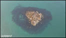
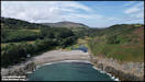
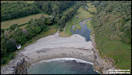
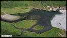
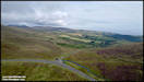
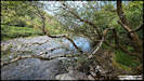
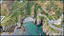
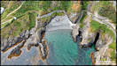
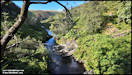
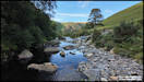
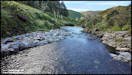
  11/8/25
After shooting the Laxey
pictures I probably had enough shots for my testing purposes, but as it
was a nice day I decided to head on to another location, Port Cornaa. It
wasn't so sheltered there, but the Air 2S can cope quite well and using
Litchi as the control program gives a better chance of 360 degree panoramas
working as it will just wait for the drone to stabilise in gusty conditions,
whereas the DJI 'Fly' app just abandons the shot and asks you to try again,
which can be very frustrating!
There was an interesting
phenomena at Port Cornaa. Normally the Cornaa River flows out to
sea in a fairly deep channel on the northern side of the pebble beach,
and at low tides the lagoon behind drains. However, there was no channel
to be seen and even at a low tide the lagoon had plenty of water in it,
I presume that water from the river must still be draining out under the
beach otherwise the lagoon would overflow and there was no sign of that,
but I wonder what might happen if we have heavy rains?
DJI Air 2S 8/8/25
11/8/25
After shooting the Laxey
pictures I probably had enough shots for my testing purposes, but as it
was a nice day I decided to head on to another location, Port Cornaa. It
wasn't so sheltered there, but the Air 2S can cope quite well and using
Litchi as the control program gives a better chance of 360 degree panoramas
working as it will just wait for the drone to stabilise in gusty conditions,
whereas the DJI 'Fly' app just abandons the shot and asks you to try again,
which can be very frustrating!
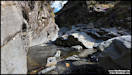
There was an interesting
phenomena at Port Cornaa. Normally the Cornaa River flows out to
sea in a fairly deep channel on the northern side of the pebble beach,
and at low tides the lagoon behind drains. However, there was no channel
to be seen and even at a low tide the lagoon had plenty of water in it,
I presume that water from the river must still be draining out under the
beach otherwise the lagoon would overflow and there was no sign of that,
but I wonder what might happen if we have heavy rains?
DJI Air 2S 8/8/25
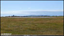
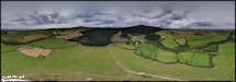
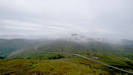
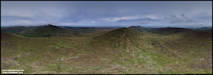
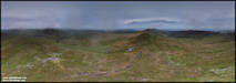
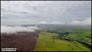
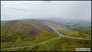
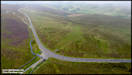
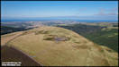
 12/8/25
It was generally bright
and sunny yesterday morning, but as it progressed patches of sea fog started
drifting inland and I decided to drive up into the hills to see if I could
capture andy dramatic shots of it with the drone. I ended up flying
from two locations, Keppel Gate and Windy Corner.
DJI Air 2S 11/8/25
12/8/25
It was generally bright
and sunny yesterday morning, but as it progressed patches of sea fog started
drifting inland and I decided to drive up into the hills to see if I could
capture andy dramatic shots of it with the drone. I ended up flying
from two locations, Keppel Gate and Windy Corner.
DJI Air 2S 11/8/25
   14/8/25
No picture uploads yesterday,
but I did manage to get the 'Find
a Picture' indices up to date to the end of July! For a lot of
the day the southern half of the island was covered in low cloud with some
murky conditions underneath, but looking at the satellite picture the northern
half looked much better. After lunch I headed up there, initial plan
was to go to the Point of Ayre for some ground level shots of the gorse
and heather in bloom, but in the end it turned into another aerial picture
day.
First stop on the way
up was at the Dog Mills, where I took a walk along the beach for some shots
of the sandy Bride Cliffs and general area.
DJI Air 2S 13/8/25
14/8/25
No picture uploads yesterday,
but I did manage to get the 'Find
a Picture' indices up to date to the end of July! For a lot of
the day the southern half of the island was covered in low cloud with some
murky conditions underneath, but looking at the satellite picture the northern
half looked much better. After lunch I headed up there, initial plan
was to go to the Point of Ayre for some ground level shots of the gorse
and heather in bloom, but in the end it turned into another aerial picture
day.
First stop on the way
up was at the Dog Mills, where I took a walk along the beach for some shots
of the sandy Bride Cliffs and general area.
DJI Air 2S 13/8/25
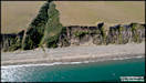    
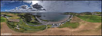
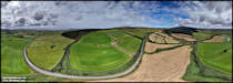
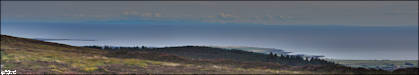
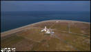
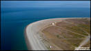
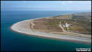
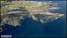
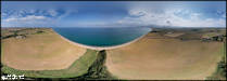 15/8/25
The second location
that I visited on Wednesday afternoon was the Point of Ayre. My original
plan had been to take ground level shots of the heather and gorse in bloom
but I seemed to have left it too late so I decided to do some aerial shots
instead. I'm always very aware up there of the possibility of disturbing
wildlife with the drone, so the plan was to lift off and and climb straight
up to 300 ft above ground before manoeuvring around for the shots.
There's always some interesting tide conditions just off the point and
there seemed to be a bit of a whirlpool forming there. Having reviewed
the still shots I now wish that I'd shot some video or time lapse!
DJI Air 2S 13/8/25
15/8/25
The second location
that I visited on Wednesday afternoon was the Point of Ayre. My original
plan had been to take ground level shots of the heather and gorse in bloom
but I seemed to have left it too late so I decided to do some aerial shots
instead. I'm always very aware up there of the possibility of disturbing
wildlife with the drone, so the plan was to lift off and and climb straight
up to 300 ft above ground before manoeuvring around for the shots.
There's always some interesting tide conditions just off the point and
there seemed to be a bit of a whirlpool forming there. Having reviewed
the still shots I now wish that I'd shot some video or time lapse!
DJI Air 2S 13/8/25
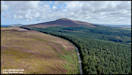
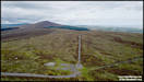
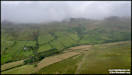
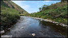
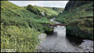
     16/8/25
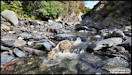
We're having a prolonged
spell of stable and warm weather at the moment and I'm taking advantage
of it by doing a lot of drone flights. However, on Thursday afternoon
after catching up with some much needed garden work, I decided that it
would be nice to have a cool down and headed for a favourite spot in Sulby
Glen, walking up the Sulby River to where there is a nice deep pool below
a little waterfall, ideal for a dip, even if it's a bit slippery underfoot!
I did quite a few pictures in this area last month on several occasions,
including some aerial shots and even a couple of videos, you can find them
in the July
section here.
Insta360 Ace Pro
14/8/25
16/8/25
We're having a prolonged
spell of stable and warm weather at the moment and I'm taking advantage
of it by doing a lot of drone flights. However, on Thursday afternoon
after catching up with some much needed garden work, I decided that it
would be nice to have a cool down and headed for a favourite spot in Sulby
Glen, walking up the Sulby River to where there is a nice deep pool below
a little waterfall, ideal for a dip, even if it's a bit slippery underfoot!
I did quite a few pictures in this area last month on several occasions,
including some aerial shots and even a couple of videos, you can find them
in the July
section here.
Insta360 Ace Pro
14/8/25
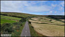
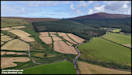
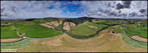
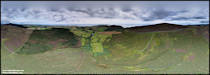
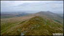
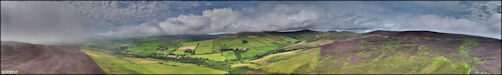
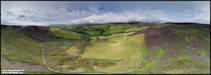
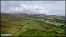
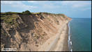
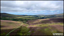
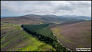
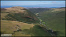
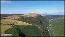
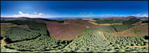
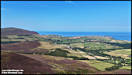
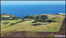
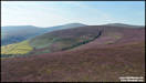
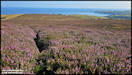
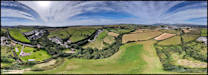
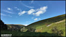
     17/8/25
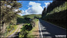
On Friday afternoon
we took a drive up into the hills to view the heather, which is in full
bloom at the moment and turning the hillsides and moorland purple.
We stopped in two locations for me to take some aerial photographs, the
first one was on the Druidale Road between Brandywell Cottage and Montpelier
Woodland.
DJI Air 2S 15/8/25
17/8/25
On Friday afternoon
we took a drive up into the hills to view the heather, which is in full
bloom at the moment and turning the hillsides and moorland purple.
We stopped in two locations for me to take some aerial photographs, the
first one was on the Druidale Road between Brandywell Cottage and Montpelier
Woodland.
DJI Air 2S 15/8/25
 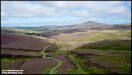  
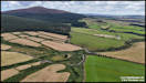
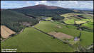
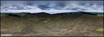
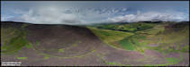
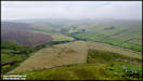
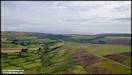
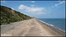
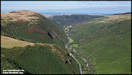
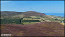
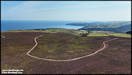
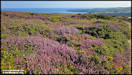
   18/7/25
These pictures were
taken at the second location we stopped at on Friday afternoon, driving
down a little unsurfaced track towards the tholtan of Killabrega, high
above Sulby Glen. More sunshine at this location as the clouds remained
over the hills to the south of us, although the heather wasn't quite as
impressive.
DJI Air 2S 15/8/25
18/7/25
These pictures were
taken at the second location we stopped at on Friday afternoon, driving
down a little unsurfaced track towards the tholtan of Killabrega, high
above Sulby Glen. More sunshine at this location as the clouds remained
over the hills to the south of us, although the heather wasn't quite as
impressive.
DJI Air 2S 15/8/25
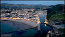
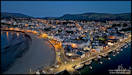
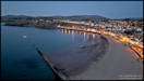
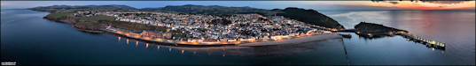
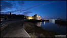
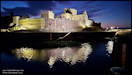
   19/8/25
Something a bit different
for me, some night aerial photography at Peel on Saturday. Technically
the first few pictures were still daytime, but anyway I was very pleased
with how the camera on the mini drone coped. The camera on the larger drone
would have been better but I don't current hold the 'Night Permission'
needed for that.
DJI Mini 4 Pro
16/8/25
19/8/25
Something a bit different
for me, some night aerial photography at Peel on Saturday. Technically
the first few pictures were still daytime, but anyway I was very pleased
with how the camera on the mini drone coped. The camera on the larger drone
would have been better but I don't current hold the 'Night Permission'
needed for that.
DJI Mini 4 Pro
16/8/25
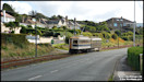
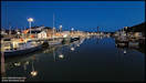
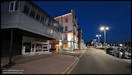
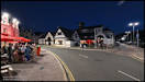
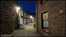
 I was in Peel to pick
up Georgie and friends after a birthday party, but still had some time
to kill before they were wanting to leave, so I had a stroll around the
streets to take some ground level pictures in the town.
Insta360 Ace Pro &
Samsung Galaxy S24 Ultra
I was in Peel to pick
up Georgie and friends after a birthday party, but still had some time
to kill before they were wanting to leave, so I had a stroll around the
streets to take some ground level pictures in the town.
Insta360 Ace Pro &
Samsung Galaxy S24 Ultra
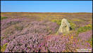
     20/8/25
On Sunday afternoon
I took myself off for a walk in the hills above Ballaragh, hoping to get
some more nice shots of the heather in bloom. I'd probably left it
a bit late, as a lot is starting to fade back to brown now. I took
some aerial pictures with the mini drone, before anybody mentions it I
was well aware of the Restricted Airspace in place around the TT course
for the MGP practice, but was flying well away from it. Much of my
walking was off established tracks, which is quite hard work through the
heather, and I didn't quite manage the distance that I'd hoped before deciding
that I should start heading back. On the way back to the car I took
a few ground level pictures.
DJI Mini 4 Pro &
Samsung Galaxy S24 Ultra 17/8/25
20/8/25
On Sunday afternoon
I took myself off for a walk in the hills above Ballaragh, hoping to get
some more nice shots of the heather in bloom. I'd probably left it
a bit late, as a lot is starting to fade back to brown now. I took
some aerial pictures with the mini drone, before anybody mentions it I
was well aware of the Restricted Airspace in place around the TT course
for the MGP practice, but was flying well away from it. Much of my
walking was off established tracks, which is quite hard work through the
heather, and I didn't quite manage the distance that I'd hoped before deciding
that I should start heading back. On the way back to the car I took
a few ground level pictures.
DJI Mini 4 Pro &
Samsung Galaxy S24 Ultra 17/8/25
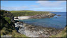
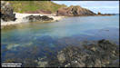
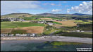
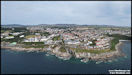
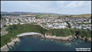
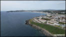
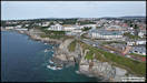
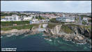
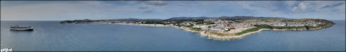
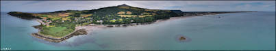
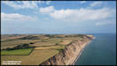
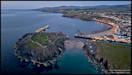
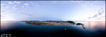
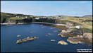
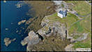
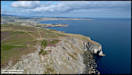
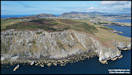
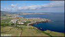
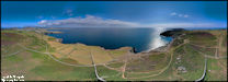
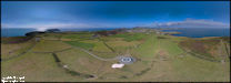
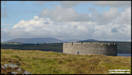
    22/8/25
Replying to a website
comment recently about a friend's house being in one of my pictures I had
a look for panoramas shot in the Perwick Bay area near Port St Mary.
I was quite surprised to find out that whilst I had done several of Port
St Mary itself and Bay-ny-Carrickey, I had none that were further to the
west. Yesterday afternoon it was rather dull and grey in Onchan,
but looked brighter to the southwest so I headed off down to Port St Mary
to rectify the situation! The panoramas actually gave me quite a
few problems during stitching with huge variations in contrast between
the dark and light areas, but I've done my best with them.
DJI Air 2S 21/8/25
22/8/25
Replying to a website
comment recently about a friend's house being in one of my pictures I had
a look for panoramas shot in the Perwick Bay area near Port St Mary.
I was quite surprised to find out that whilst I had done several of Port
St Mary itself and Bay-ny-Carrickey, I had none that were further to the
west. Yesterday afternoon it was rather dull and grey in Onchan,
but looked brighter to the southwest so I headed off down to Port St Mary
to rectify the situation! The panoramas actually gave me quite a
few problems during stitching with huge variations in contrast between
the dark and light areas, but I've done my best with them.
DJI Air 2S 21/8/25
  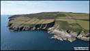  
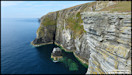
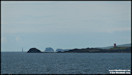
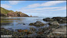
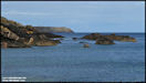
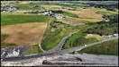
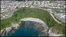
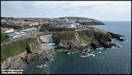
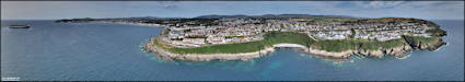
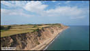
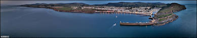
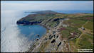
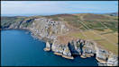
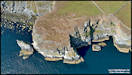
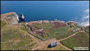
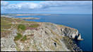
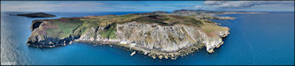
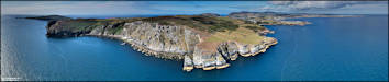
  23/8/25
After completing my
flight and photography at Perwick Bay, I headed up through Cregneash and
to the Chasms for a further flight. I had hoped that most of the
breeding birds on the Sugarloaf Rock might have left and I could fly low
over the sea for some dramatic shots, but when I arrived at a suitable
observation point there were still quite a few there so I kept the flying
to higher levels to avoid any disturbance to them.
DJI Air 2S 21/8/25
23/8/25
After completing my
flight and photography at Perwick Bay, I headed up through Cregneash and
to the Chasms for a further flight. I had hoped that most of the
breeding birds on the Sugarloaf Rock might have left and I could fly low
over the sea for some dramatic shots, but when I arrived at a suitable
observation point there were still quite a few there so I kept the flying
to higher levels to avoid any disturbance to them.
DJI Air 2S 21/8/25
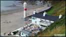
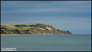
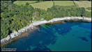
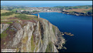
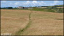
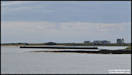
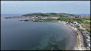
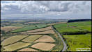
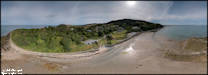
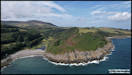
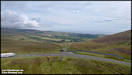
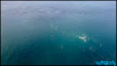
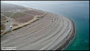
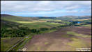
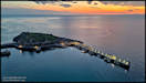
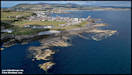
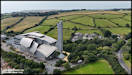
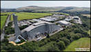
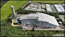
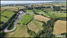
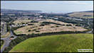
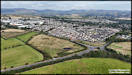
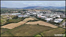
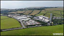
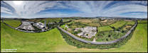
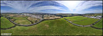
  25/8/25
Something a little different!
Yesterday morning I needed to drop some things off at the local recycling
facility, located at the Middle Park Industrial Estate just south of Douglas.
I took the mini drone along with me intending to shoot some pictures later
of the cruise ships visiting, but thought that I would do a flight first
near to the industrial estate. It is home to the Energy From Waste
plant, which incinerates most of the island's refuse, whilst generating
electricity to be fed back into the grid.
DJI Mini 4 Pro 24/8/25
25/8/25
Something a little different!
Yesterday morning I needed to drop some things off at the local recycling
facility, located at the Middle Park Industrial Estate just south of Douglas.
I took the mini drone along with me intending to shoot some pictures later
of the cruise ships visiting, but thought that I would do a flight first
near to the industrial estate. It is home to the Energy From Waste
plant, which incinerates most of the island's refuse, whilst generating
electricity to be fed back into the grid.
DJI Mini 4 Pro 24/8/25
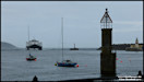
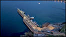
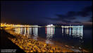
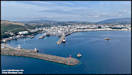
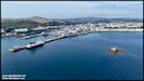
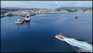
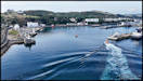
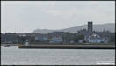
   26/8/25
These pictures were
the reason that I had taken the mini drone with me on the trip to the recycling
centre! I wanted to try and capture the two cruise ships that were
visiting that day, one was moored on the outside of the Victoria Pier and
one was anchored out in the bay, along with the Steam Packet's 'Ben my
Chree', displaced from the pier by the cruise ship 'Corinthian'.
An added bonus was the appearance of the new Douglas Lifeboat, coming back
to port from a training session. Towards the end of the flight I
shot a few pictures of the Douglas Head area and the old Port Skillion
bathing pool area being used by sea swimmers.
DJI Mini 4 Pro 24/8/25
26/8/25
These pictures were
the reason that I had taken the mini drone with me on the trip to the recycling
centre! I wanted to try and capture the two cruise ships that were
visiting that day, one was moored on the outside of the Victoria Pier and
one was anchored out in the bay, along with the Steam Packet's 'Ben my
Chree', displaced from the pier by the cruise ship 'Corinthian'.
An added bonus was the appearance of the new Douglas Lifeboat, coming back
to port from a training session. Towards the end of the flight I
shot a few pictures of the Douglas Head area and the old Port Skillion
bathing pool area being used by sea swimmers.
DJI Mini 4 Pro 24/8/25

 28/8/25
I took these pictures
yesterday afternoon on a little stroll around in Sulby Glen, at the location
where the Block Eary stream joins the main river. I was taking advantage
of a later than planned road closure for the Manx Grand Prix, due to heavy
rain earlier in the day. My original plan had been to shoot it as
video, hence the use of the Osmo Pocket 3 as camera, but in the end I wasn't
really inspired and shot stills instead. You'll just have to imagine
the water sound as the streams rush past the rocks! Maybe I'll go
back again another day to shoot the video, but I often have these ideas
and then forget them.
DJI Osmo Pocket 3
27/8/25
28/8/25
I took these pictures
yesterday afternoon on a little stroll around in Sulby Glen, at the location
where the Block Eary stream joins the main river. I was taking advantage
of a later than planned road closure for the Manx Grand Prix, due to heavy
rain earlier in the day. My original plan had been to shoot it as
video, hence the use of the Osmo Pocket 3 as camera, but in the end I wasn't
really inspired and shot stills instead. You'll just have to imagine
the water sound as the streams rush past the rocks! Maybe I'll go
back again another day to shoot the video, but I often have these ideas
and then forget them.
DJI Osmo Pocket 3
27/8/25
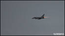
     29/8/25
A few pictures of last
night's amazing display by RAF Typhoon FGR4 ZK329 'REHEAT01' over Douglas
Bay. A very impressive and noisy display, we just watched it from
home so the pictures are from around two miles away and quite heavily cropped.
Tracking map courtesy of FlightRadar 24.
Nikon D7100 28/8/25
29/8/25
A few pictures of last
night's amazing display by RAF Typhoon FGR4 ZK329 'REHEAT01' over Douglas
Bay. A very impressive and noisy display, we just watched it from
home so the pictures are from around two miles away and quite heavily cropped.
Tracking map courtesy of FlightRadar 24.
Nikon D7100 28/8/25

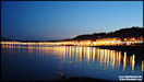
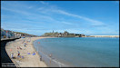
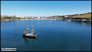
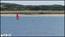
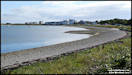
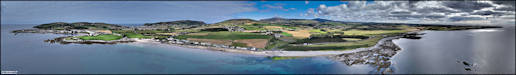
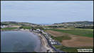
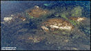
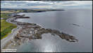
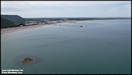
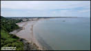
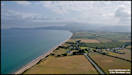
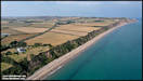
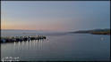
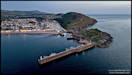
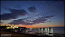
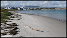
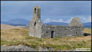
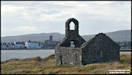
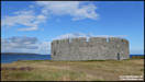
     30/8/25
Looking at the weather
forecast for the weekend (rain and strong winds!) this might be my last
posting for the month. I took these pictures yesterday afternoon
on a stroll around Derbyhaven Bay. After a few rainshowers earlier,
it was bright and sunny in the south of the island with a warm breeze blowing.
Panasonic TZ95
29/8/25
30/8/25
Looking at the weather
forecast for the weekend (rain and strong winds!) this might be my last
posting for the month. I took these pictures yesterday afternoon
on a stroll around Derbyhaven Bay. After a few rainshowers earlier,
it was bright and sunny in the south of the island with a warm breeze blowing.
Panasonic TZ95
29/8/25
  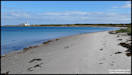  
   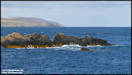 
    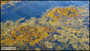
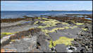
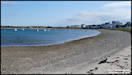
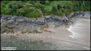
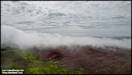
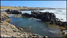
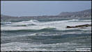
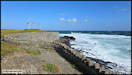
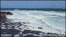
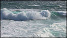
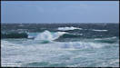
     1/9/25
I said in my last post
that it was likely to be the last selection for August, but despite gale
force winds we were tempted out by bright sunshine yesterday afternoon
and headed south to see the waves hitting the coastline, stopping at two
locations for photos. The first stop was at Poyll Vaaish, coincidentally
almost exactly a month after the last time that I was there on the 31st
of July, although conditions were quite different! It was in fact quite
difficult to hold the phone camera steady in the wind.
Samsung Galaxy S24 Ultra
30/8/25
1/9/25
I said in my last post
that it was likely to be the last selection for August, but despite gale
force winds we were tempted out by bright sunshine yesterday afternoon
and headed south to see the waves hitting the coastline, stopping at two
locations for photos. The first stop was at Poyll Vaaish, coincidentally
almost exactly a month after the last time that I was there on the 31st
of July, although conditions were quite different! It was in fact quite
difficult to hold the phone camera steady in the wind.
Samsung Galaxy S24 Ultra
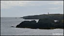
30/8/25
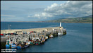
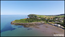
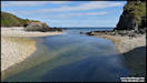
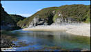
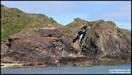
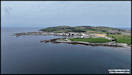
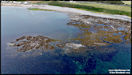
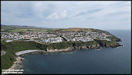
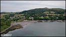
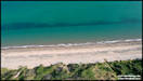
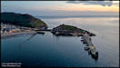
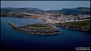
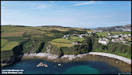
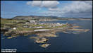
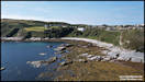
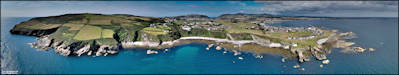
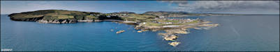
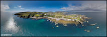
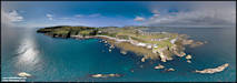
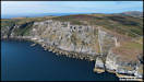
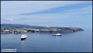
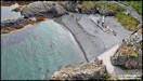
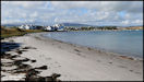
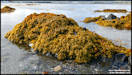
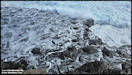
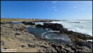  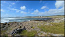  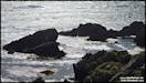 Kallow Point, Port St
Mary
Kallow Point, Port St
Mary
|