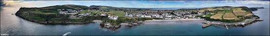
Twenty Five Years
of Island Images - July 2000 - 2024
|
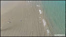
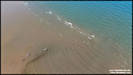
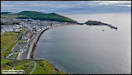
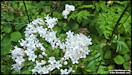
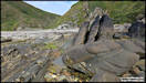
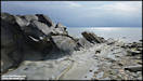
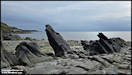
3/7/25
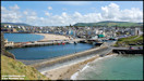
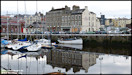
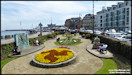
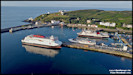
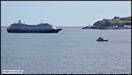
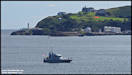
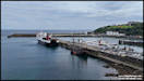
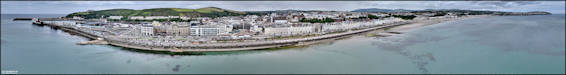
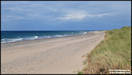
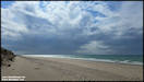
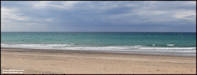
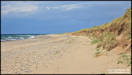
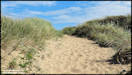
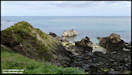
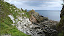
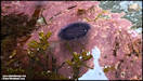
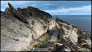
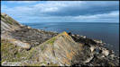
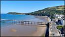
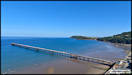
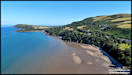
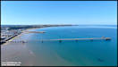
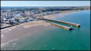
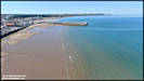
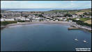
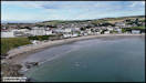
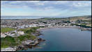
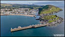
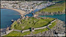
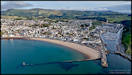
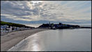
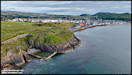
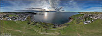
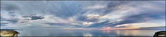
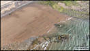
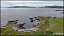
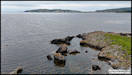
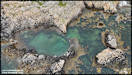
Three nautically themed
pictures taken at Douglas Bay yesterday afternoon (on the way to the shops!)
Samsung Galaxy S24 Ultra
2/7/25
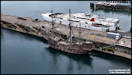
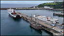
   4/7/25
Happy Independence Day
to my visitors from the USA!
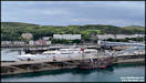
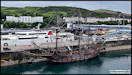
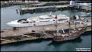
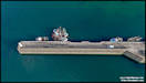
We currently have a
(replica) Spanish Galleon visiting in Douglas Harbour. Due to where
she is moored it's a bit difficult to get good ground level photographs
of her, so yesterday afternoon I though I'd try to get some using the mini
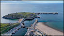
drone. Conditions weren't ideal as the wind was a little on the strong
side for the Mini 4 and there were fairly regular rain showers passing
through. Apart from on the first pic I've taken the liberty of cloning
out the bright orange RIB dangling over her side!
For more information
'El Galleon' has a webpage in English here.
DJI Mini 4 Pro 3/7/25
4/7/25
Happy Independence Day
to my visitors from the USA!
We currently have a
(replica) Spanish Galleon visiting in Douglas Harbour. Due to where
she is moored it's a bit difficult to get good ground level photographs
of her, so yesterday afternoon I though I'd try to get some using the mini
drone. Conditions weren't ideal as the wind was a little on the strong
side for the Mini 4 and there were fairly regular rain showers passing
through. Apart from on the first pic I've taken the liberty of cloning
out the bright orange RIB dangling over her side!
For more information
'El Galleon' has a webpage in English here.
DJI Mini 4 Pro 3/7/25
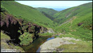
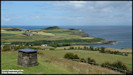
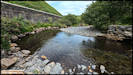
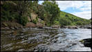
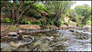
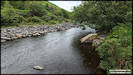
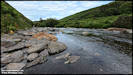
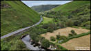
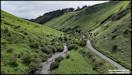
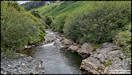
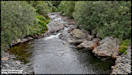
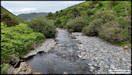
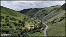
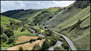
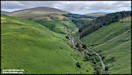
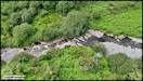
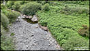
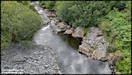
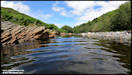
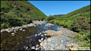
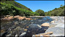
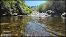
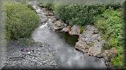
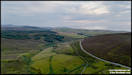
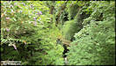
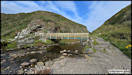
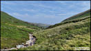
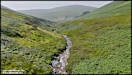
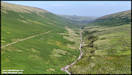
 After shooting the pictures
at Douglas, I decided to head towards the north west of the island, driving
via Sulby Glen. There was a heavy rainshower on the way but by the
time I reached the bottom of the glen it had stopped, with sunshine reaching
through the clouds, and I stopped at a favourite spot by the river.
Staring with a few ground level shots right by the river, then some aerial
pictures culminating with a short video flying along the river.
Insta360 Ace Pro &
DJI Mini 4 Pro 3/7/25
After shooting the pictures
at Douglas, I decided to head towards the north west of the island, driving
via Sulby Glen. There was a heavy rainshower on the way but by the
time I reached the bottom of the glen it had stopped, with sunshine reaching
through the clouds, and I stopped at a favourite spot by the river.
Staring with a few ground level shots right by the river, then some aerial
pictures culminating with a short video flying along the river.
Insta360 Ace Pro &
DJI Mini 4 Pro 3/7/25
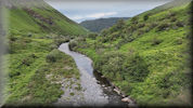
    A short video flying
up the valley over the river. (3:56)
A short video flying
up the valley over the river. (3:56)
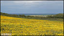
 5/7/25
Happy Tynwald Day!
(Although as it's a
Saturday the ceremony and public holiday is on Monday!)
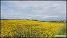
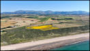
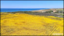
On Thursday afternoon,
after my pause for photos in Sulby Glen, I continued on to the the north
west coast, with no particular destination in mind. Just to
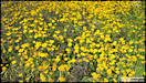
the north of Jurby near The Lhen I came across this bright yellow field,
not the usual Oilseed Rape, but a more daisy shaped flower. I presume
that it's being grown as a cultivated crop as the whole field was full
of it. I would have liked to take some aerial shots but it was just
too windy for the mini drone there. After that I went on to the beach
just north of there at Cronk y Bing where there is a lovely little nature
reserve in the dunes behind the actual beach, although I didn't actually
go in.
Update - the yellow
flowers are Corn Marigolds!
Panasonic TZ95 &
Samsung Galaxy S24 Ultra 3/7/25
5/7/25
Happy Tynwald Day!
(Although as it's a
Saturday the ceremony and public holiday is on Monday!)
On Thursday afternoon,
after my pause for photos in Sulby Glen, I continued on to the the north
west coast, with no particular destination in mind. Just to
the north of Jurby near The Lhen I came across this bright yellow field,
not the usual Oilseed Rape, but a more daisy shaped flower. I presume
that it's being grown as a cultivated crop as the whole field was full
of it. I would have liked to take some aerial shots but it was just
too windy for the mini drone there. After that I went on to the beach
just north of there at Cronk y Bing where there is a lovely little nature
reserve in the dunes behind the actual beach, although I didn't actually
go in.
Update - the yellow
flowers are Corn Marigolds!
Panasonic TZ95 &
Samsung Galaxy S24 Ultra 3/7/25
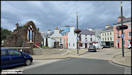
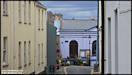
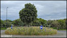
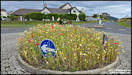
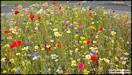
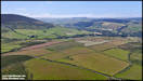
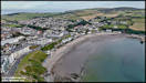
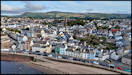
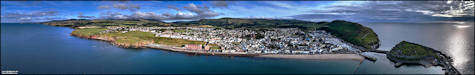
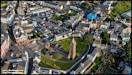
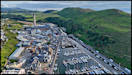
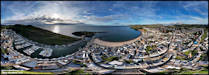
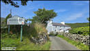
   6/7/25
Yesterday afternoon
we did a trip to St John's and then Peel to visit a couple of shops.
I took a few pictures in Peel and then a series at the amazing wildflower
sown roundabouts on the Poortown Road. We came back via a 'scenic
route' and I stopped for a few photos by the end of the Little London road.
Samsung Galaxy S24 Ultra
5/7/25
6/7/25
Yesterday afternoon
we did a trip to St John's and then Peel to visit a couple of shops.
I took a few pictures in Peel and then a series at the amazing wildflower
sown roundabouts on the Poortown Road. We came back via a 'scenic
route' and I stopped for a few photos by the end of the Little London road.
Samsung Galaxy S24 Ultra
5/7/25
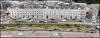
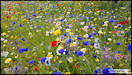
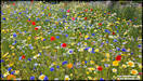
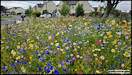
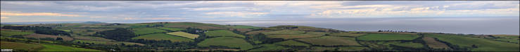
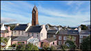
   Roundabouts of Peel!
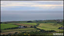
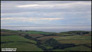
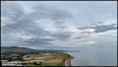
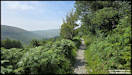
     Continuing our journey
home, stopping at the end of the Little London road to take in the views.
A bit overcast and dull, but fantastic scenery!
As I considered all
the originals to be on the 'flat' side, I've processed alternatives in
Snapseed, click the big images to see the alternative.
Continuing our journey
home, stopping at the end of the Little London road to take in the views.
A bit overcast and dull, but fantastic scenery!
As I considered all
the originals to be on the 'flat' side, I've processed alternatives in
Snapseed, click the big images to see the alternative.
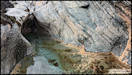
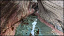
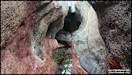
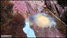
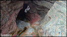
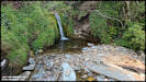
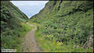
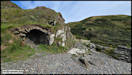
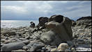
 8/7/25
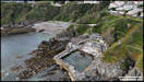
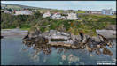
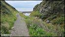
A walk down from the
main road to Dhoon Beach, not taking my usual route down in the glen past
the waterfall (which may still be closed anyway) but using the outside
path that follows the top of the south side of the glen, before dropping
down to the beach via a series of zig-zags. I was deliberately going
at low tide as I wanted to visit a feature that I discovered many years
ago and christened 'The Mermaid's Cave', which vanishes below water at
high tide.
Panasonic TZ95 &
Insta360 Ace Pro 7/7/25
8/7/25
A walk down from the
main road to Dhoon Beach, not taking my usual route down in the glen past
the waterfall (which may still be closed anyway) but using the outside
path that follows the top of the south side of the glen, before dropping
down to the beach via a series of zig-zags. I was deliberately going
at low tide as I wanted to visit a feature that I discovered many years
ago and christened 'The Mermaid's Cave', which vanishes below water at
high tide.
Panasonic TZ95 &
Insta360 Ace Pro 7/7/25
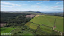
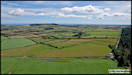
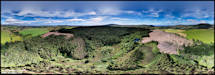
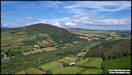
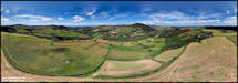
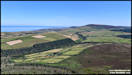
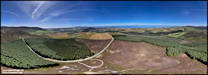
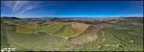
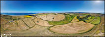
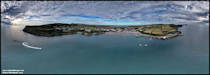
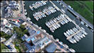
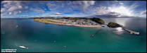
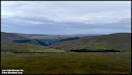
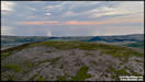
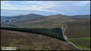
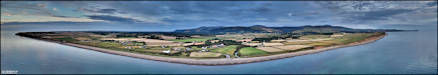
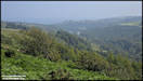
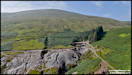
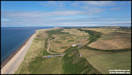
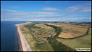
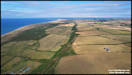
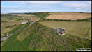
     10/7/25
We're currently in a
stable weather situation on the island, with high pressure giving (generally!)
blue skies and light winds. Yesterday afternoon I decided to do some
aerial photography, flying from two locations either side of Archallagan
Plantation on the south side of the central valley, looking over the 'Plains
of Heaven'. The plantation used to one of the nicest on the island to walk
through, but is currently completely closed off to the public with huge
areas being completely cleared of trees, supposedly after storm damage.
Whether there will be anything left worth walking in when they have finished
remains to be seen.
The first set of pictures
are from the eastern side of Archallagan.
DJI Air 2S 9/7/25
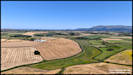
10/7/25
We're currently in a
stable weather situation on the island, with high pressure giving (generally!)
blue skies and light winds. Yesterday afternoon I decided to do some
aerial photography, flying from two locations either side of Archallagan
Plantation on the south side of the central valley, looking over the 'Plains
of Heaven'. The plantation used to one of the nicest on the island to walk
through, but is currently completely closed off to the public with huge
areas being completely cleared of trees, supposedly after storm damage.
Whether there will be anything left worth walking in when they have finished
remains to be seen.
The first set of pictures
are from the eastern side of Archallagan.
DJI Air 2S 9/7/25
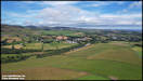   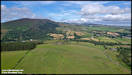 
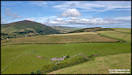
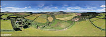
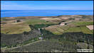
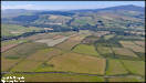
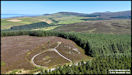
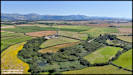
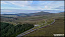
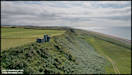
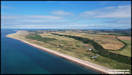
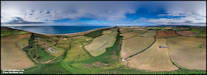
  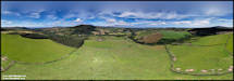 11/7/25
I didn't have time yesterday
to do the second set of pictures from the Archallagan area, mainly because
I had a very enjoyable afternoon splashing around in the Sulby River!
Pictures and (maybe) a video to come later. So these are the pictures
shot from the western side of Archallagan, looking over the central valley.
DJI Air 2S 9/7/25
11/7/25
I didn't have time yesterday
to do the second set of pictures from the Archallagan area, mainly because
I had a very enjoyable afternoon splashing around in the Sulby River!
Pictures and (maybe) a video to come later. So these are the pictures
shot from the western side of Archallagan, looking over the central valley.
DJI Air 2S 9/7/25
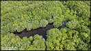
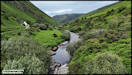
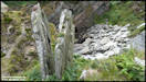
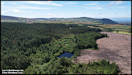
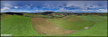
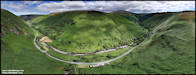
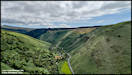
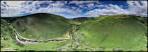
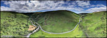
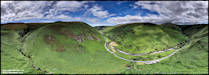
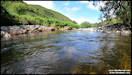
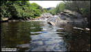
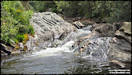
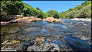
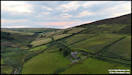
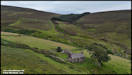
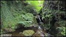
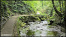
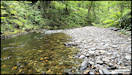
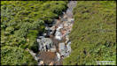
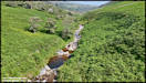
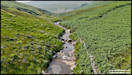
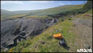
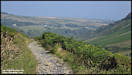
  12/7/25
As mentioned in the
previous set of pictures, on Thursday afternoon I did a bit of 'river walking',
a short distance up the Sulby River where it passes through the narrowest
section of the glen. It's been hot here recently and the river water
was lovely and cooling on the feet and ankles and at the end of the short
walk I was able to take a dip in one of the deep pools. A word of
warning, the stones in the river are very slippery and there are large
underwater boulders in the pool!
The pictures here aren't
in the order taken, as I thought it would be best to start with the aerial
shots showing the amazing location. I love it that you can still
see the locations of the tracks, now covered with bracken, that served
the upland farms that have probably been disused for over 75 years now
in most cases.
DJI Mini 4 Pro, DJI
Osmo Pocket 3, GoPro 9, Samsung Galaxy S24 Ultra 10/7/25
12/7/25
As mentioned in the
previous set of pictures, on Thursday afternoon I did a bit of 'river walking',
a short distance up the Sulby River where it passes through the narrowest
section of the glen. It's been hot here recently and the river water
was lovely and cooling on the feet and ankles and at the end of the short
walk I was able to take a dip in one of the deep pools. A word of
warning, the stones in the river are very slippery and there are large
underwater boulders in the pool!
The pictures here aren't
in the order taken, as I thought it would be best to start with the aerial
shots showing the amazing location. I love it that you can still
see the locations of the tracks, now covered with bracken, that served
the upland farms that have probably been disused for over 75 years now
in most cases.
DJI Mini 4 Pro, DJI
Osmo Pocket 3, GoPro 9, Samsung Galaxy S24 Ultra 10/7/25
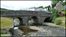
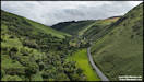
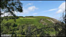
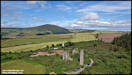
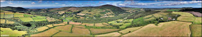
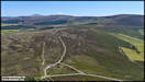
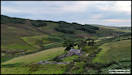
     13/7/25
With the recent good
weather and light winds, I've been taking advantage and doing quite a lot
of aerial photography using the drones. On friday morning I took
a trip up the (very narrow and twisting) lane from Greeba Bridge, up to
a spot in the hills that seems to go by various names! There is Beary
Mountain, which seems common across most maps. Nearby, on modern maps is
Beary Park (where I actually flew from), but on the 1870 map is marked
as Beary Pairk. To finally confuse things even more, there is a TV transmitter
up here, which is called Beary Peark! At only just over 1,000 ft
above sea level, Beary Mountain isn't technically a mountain, but for the
sake of simplicity, I'll just use that in the picture titles.
DJI Mini 4 Pro
11/7/25
13/7/25
With the recent good
weather and light winds, I've been taking advantage and doing quite a lot
of aerial photography using the drones. On friday morning I took
a trip up the (very narrow and twisting) lane from Greeba Bridge, up to
a spot in the hills that seems to go by various names! There is Beary
Mountain, which seems common across most maps. Nearby, on modern maps is
Beary Park (where I actually flew from), but on the 1870 map is marked
as Beary Pairk. To finally confuse things even more, there is a TV transmitter
up here, which is called Beary Peark! At only just over 1,000 ft
above sea level, Beary Mountain isn't technically a mountain, but for the
sake of simplicity, I'll just use that in the picture titles.
DJI Mini 4 Pro
11/7/25
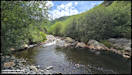
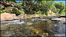
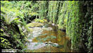
 14/7/25
Some more Sulby River
pics! I was heading north through Sulby Glen on Saturday afternoon
and as it seemed quiet, decided to have a short stop there for a refreshing
dip in one of the pools.
Insta 360 Ace Pro
12/7/25
14/7/25
Some more Sulby River
pics! I was heading north through Sulby Glen on Saturday afternoon
and as it seemed quiet, decided to have a short stop there for a refreshing
dip in one of the pools.
Insta 360 Ace Pro
12/7/25
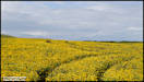
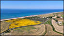
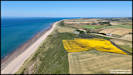
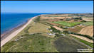
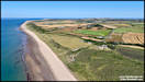
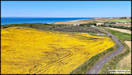
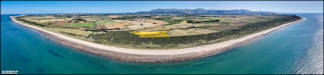
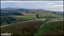
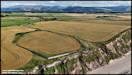
     Heading onwards from
Sulby Glen, I wanted to see if the Corn Marigolds were still in bloom at
The Lhen and get some aerial views of them and the surrounding countryside
now that the winds had fallen lighter. The major geographical feature
here is the Lhen Trench, a shallow valley formed in the last ice age, when
the glaciers covering the uplands of the island were melting and their
waters flowing out to the sea.
DJI Mini 4 Pro &
Samsung Galaxy S24 Ultra 12/7/25
Heading onwards from
Sulby Glen, I wanted to see if the Corn Marigolds were still in bloom at
The Lhen and get some aerial views of them and the surrounding countryside
now that the winds had fallen lighter. The major geographical feature
here is the Lhen Trench, a shallow valley formed in the last ice age, when
the glaciers covering the uplands of the island were melting and their
waters flowing out to the sea.
DJI Mini 4 Pro &
Samsung Galaxy S24 Ultra 12/7/25
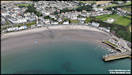
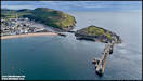
 15/7/25
On Saturday afternoon
I was on my way back home from The Lhen, going via Ramsey and Laxey, when
I saw lots of people still enjoying the south beach at Ramsey at around
5 o'Clock in the afternoon. This was the beach that a misguided developer
wanted to 'reclaim' to build houses and a marina on, removing most of the
existing superb sandy beach between the harbour breakwater and Queen's
Pier, and making a very small 'new' beach near to the pier. Fortunately
it all seems to have been shelved after huge public opposition (although
amazingly there were some that actually supported it as well). I
was just staggered that our government just didn't say right from the outset
that a public beach didn't need 'reclaimed' as a building site, but maybe
there was money to be made..... Anyway, on Saturday the beach was
being used for proper purposes and I stopped and took a series of aerial
photographs, trying to keep well away from the people enjoying themselves
on the sands an in the sea.
DJI Mini 4 Pro 12/7/25
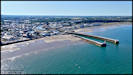
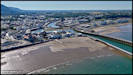
15/7/25
On Saturday afternoon
I was on my way back home from The Lhen, going via Ramsey and Laxey, when
I saw lots of people still enjoying the south beach at Ramsey at around
5 o'Clock in the afternoon. This was the beach that a misguided developer
wanted to 'reclaim' to build houses and a marina on, removing most of the
existing superb sandy beach between the harbour breakwater and Queen's
Pier, and making a very small 'new' beach near to the pier. Fortunately
it all seems to have been shelved after huge public opposition (although
amazingly there were some that actually supported it as well). I
was just staggered that our government just didn't say right from the outset
that a public beach didn't need 'reclaimed' as a building site, but maybe
there was money to be made..... Anyway, on Saturday the beach was
being used for proper purposes and I stopped and took a series of aerial
photographs, trying to keep well away from the people enjoying themselves
on the sands an in the sea.
DJI Mini 4 Pro 12/7/25
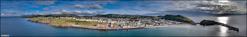
     17/7/25
Yesterday I finally
got around to editing the video that I shot on my 'river walk' in Sulby
Glen on the 10th. It won't be winning any Oscars, but I enjoyed shooting
and editing it up! It has a couple of aerial sequences towards the
end and I hope the sound works OK for them. Click the image for the
YouTube link to the video and don't forget to select '1080p' or 'HD' when
you get there as it sometimes gives the low resolution 720 version by default.
DJI Osmo Pocket 3 &
DJI Mini 4 Pro 10/7/25
17/7/25
Yesterday I finally
got around to editing the video that I shot on my 'river walk' in Sulby
Glen on the 10th. It won't be winning any Oscars, but I enjoyed shooting
and editing it up! It has a couple of aerial sequences towards the
end and I hope the sound works OK for them. Click the image for the
YouTube link to the video and don't forget to select '1080p' or 'HD' when
you get there as it sometimes gives the low resolution 720 version by default.
DJI Osmo Pocket 3 &
DJI Mini 4 Pro 10/7/25
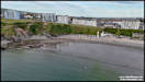
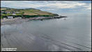
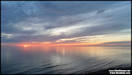
 Yesterday evening I
had to drop Georgie off at Ronaldsway for a flight to Edinburgh and afterwards
headed west to do some aerial photography at Port Erin. I was initially
disappointed that it had clouded over a but, but it gave some great
lighting effects. Apparently I missed a superb sunset by going home
too soon, but I was hungry!
DJI Mini 4 Pro
16/7/25
Yesterday evening I
had to drop Georgie off at Ronaldsway for a flight to Edinburgh and afterwards
headed west to do some aerial photography at Port Erin. I was initially
disappointed that it had clouded over a but, but it gave some great
lighting effects. Apparently I missed a superb sunset by going home
too soon, but I was hungry!
DJI Mini 4 Pro
16/7/25
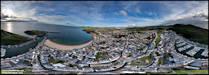
 19/7/25
Some more evening aerial
photography from the west coast yesterday, this time the location was Peel.
I ended up flying from three different locations around the town.
I find that the large
ugly concrete chimney on the power station can be very intrusive in pictures,
so I've taken the liberty of cloning it out for a few! I shot a few 360
degree panoramas and as is my usual practice I'll leave those to the end.
DJI Mini 4 Pro
18/7/25
19/7/25
Some more evening aerial
photography from the west coast yesterday, this time the location was Peel.
I ended up flying from three different locations around the town.
I find that the large
ugly concrete chimney on the power station can be very intrusive in pictures,
so I've taken the liberty of cloning it out for a few! I shot a few 360
degree panoramas and as is my usual practice I'll leave those to the end.
DJI Mini 4 Pro
18/7/25
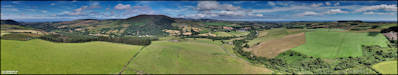
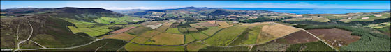
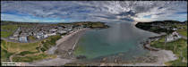
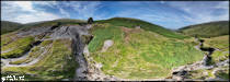
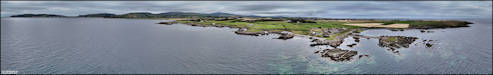
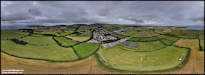
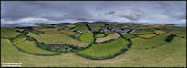
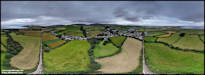
    The 360 degree interactive
panoramas. Don't forget to click on the larger images for the interactive
version!
The 360 degree interactive
panoramas. Don't forget to click on the larger images for the interactive
version!
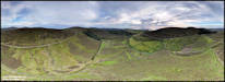
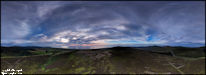
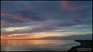
    21/7/25
I had another evening
excursion on Saturday with the drone. The plan was to head up to
the high ground near Sartfell and hopefully get some shots around that
area in nice evening sunlight, possibly waiting for the sunset, which was
due at 21:38. However, the cloud had other ideas and there was no
sign of the sun when I arrived! I did one flight anyway, looking
at the upper Rhenass valley and surrounding area including the tholtan
of Cronkdhoo, down in the valley. I almost went back home from there,
but in the end decided to continue northwards towards Ballaugh Shore, in
the hope of a nice sunset, and I wasn't disappointed! Those pics
will follow in another upload though.
DJI Mini 4 Pro 19/7/25
21/7/25
I had another evening
excursion on Saturday with the drone. The plan was to head up to
the high ground near Sartfell and hopefully get some shots around that
area in nice evening sunlight, possibly waiting for the sunset, which was
due at 21:38. However, the cloud had other ideas and there was no
sign of the sun when I arrived! I did one flight anyway, looking
at the upper Rhenass valley and surrounding area including the tholtan
of Cronkdhoo, down in the valley. I almost went back home from there,
but in the end decided to continue northwards towards Ballaugh Shore, in
the hope of a nice sunset, and I wasn't disappointed! Those pics
will follow in another upload though.
DJI Mini 4 Pro 19/7/25
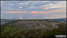    
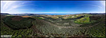
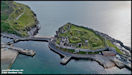
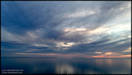
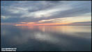
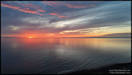
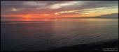
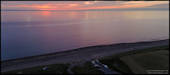
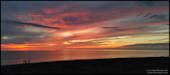
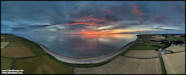
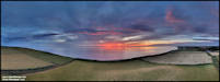
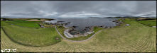
  22/7/25
Sunset Beach!
After the inland flight
I headed onwards to the coast at Ballaugh Shore in the hope of catching
the sunset, which was due in a bit under an hour. When I arrived I wasn't
that impressed with the chances, as there was a lot of cloud around, but
decided to shoot a few aerial pictures anyway. I might well have
left it at that and headed home, had not fellow IOM photographer Julian
Simmonds come up to me and suggested that it might well be worth staying
on just to see what might happen - he was right!
Starting a bit unusually
with a 360 degree panorama to set the scene. Later on I tried the Mini
4 Pro's '180 degree Panorama' setting and those will appear at the end.
DJI Mini 4 Pro 19/7/25
22/7/25
Sunset Beach!
After the inland flight
I headed onwards to the coast at Ballaugh Shore in the hope of catching
the sunset, which was due in a bit under an hour. When I arrived I wasn't
that impressed with the chances, as there was a lot of cloud around, but
decided to shoot a few aerial pictures anyway. I might well have
left it at that and headed home, had not fellow IOM photographer Julian
Simmonds come up to me and suggested that it might well be worth staying
on just to see what might happen - he was right!
Starting a bit unusually
with a 360 degree panorama to set the scene. Later on I tried the Mini
4 Pro's '180 degree Panorama' setting and those will appear at the end.
DJI Mini 4 Pro 19/7/25
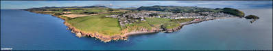
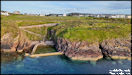
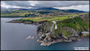
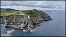
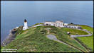
    23/7/25
A bit of aerial photography
around the Maughold Lighthouse area on Monday afternoon. The lighthouse
was constructed as recently as 1914 and is rather precariously perched
part way down the cliff! It's fully automated these days and the
former lighthouses keepers cottages on the clifftop were converted to a
private residence but, from the photographs, don't look to be inhabited
any more.
DJI Mini 4 Pro 21/7/25
23/7/25
A bit of aerial photography
around the Maughold Lighthouse area on Monday afternoon. The lighthouse
was constructed as recently as 1914 and is rather precariously perched
part way down the cliff! It's fully automated these days and the
former lighthouses keepers cottages on the clifftop were converted to a
private residence but, from the photographs, don't look to be inhabited
any more.
DJI Mini 4 Pro 21/7/25
  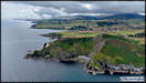  
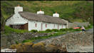
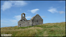
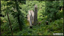
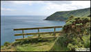
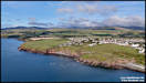
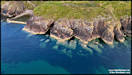
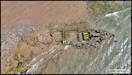
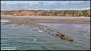
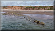
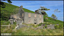
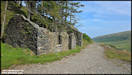
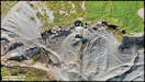
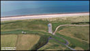
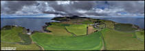 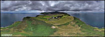 24/7/25
After my Maughold Head
flight on Monday afternoon I looked for somewhere else to carry out another
flight. Consulting the tide tables (on my watch!) I realised that
it was low tide and thought that I would try for some aerial shots of the
'Pasages', a steam trawler that was wrecked on the west coast in December
1931. Quite a bit of the wreck still exists on the beach close to Jurby
Head, but it's covered with water at all but low tides. I parked
at Sartfield and walked down the beach to reach it.
You can read the story
of 'Pasages' here.
The story of the wreck (and many others) is also covered in the excellent
'Strandings
and Sinkings' by Loaghtan Books.
I didn't shoot any panoramas
from this location, but there is a chance of some video once I've edited
it!
DJI Mini 4 Pro 21/7/25
24/7/25
After my Maughold Head
flight on Monday afternoon I looked for somewhere else to carry out another
flight. Consulting the tide tables (on my watch!) I realised that
it was low tide and thought that I would try for some aerial shots of the
'Pasages', a steam trawler that was wrecked on the west coast in December
1931. Quite a bit of the wreck still exists on the beach close to Jurby
Head, but it's covered with water at all but low tides. I parked
at Sartfield and walked down the beach to reach it.
You can read the story
of 'Pasages' here.
The story of the wreck (and many others) is also covered in the excellent
'Strandings
and Sinkings' by Loaghtan Books.
I didn't shoot any panoramas
from this location, but there is a chance of some video once I've edited
it!
DJI Mini 4 Pro 21/7/25
     Update! I edited
the video clips together and uploaded to YouTube:
Update! I edited
the video clips together and uploaded to YouTube:
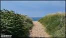
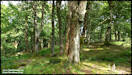
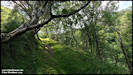
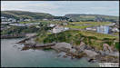
 25/7/25
On Tuesday afternoon
I had a walk down through the lush vegetation of Glen Maye, followed by
a bit of exploring to the south and north of the main beach.
Samsung Galaxy S24 Ultra
22/7/25
25/7/25
On Tuesday afternoon
I had a walk down through the lush vegetation of Glen Maye, followed by
a bit of exploring to the south and north of the main beach.
Samsung Galaxy S24 Ultra
22/7/25
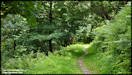
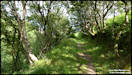
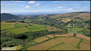
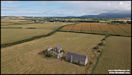
    26/7/25
On Thursday afternoon
I walked up the Laxey Glen track from Agneash to the old Snaefell Mine,
scene of the worst mining disaster on the island in May 1897 when twenty
men out of a shift of thirty five lost their lives after descending unknowingly
into the mine which was filled with lethal carbon monoxide gas after an
overnight fire.
On the way up there
I took a detour down the hillside to the river.
Samsung Galaxy S24 Ultra
& DJI Mini 4 Pro 24/7/25
26/7/25
On Thursday afternoon
I walked up the Laxey Glen track from Agneash to the old Snaefell Mine,
scene of the worst mining disaster on the island in May 1897 when twenty
men out of a shift of thirty five lost their lives after descending unknowingly
into the mine which was filled with lethal carbon monoxide gas after an
overnight fire.
On the way up there
I took a detour down the hillside to the river.
Samsung Galaxy S24 Ultra
& DJI Mini 4 Pro 24/7/25
    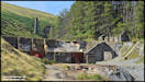
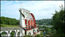
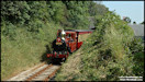
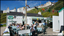
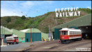
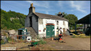
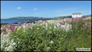
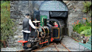
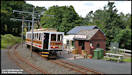
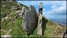
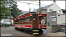
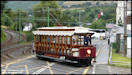
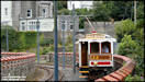
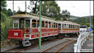
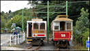
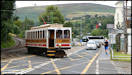
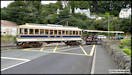
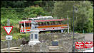
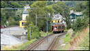
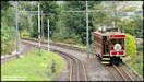
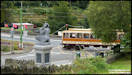
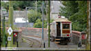
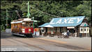
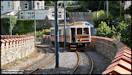
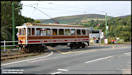
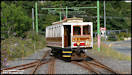
 27/7/25
An afternoon tram watching
at Laxey Station.
Panasonic TZ95 26/7/25
27/7/25
An afternoon tram watching
at Laxey Station.
Panasonic TZ95 26/7/25
    
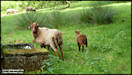
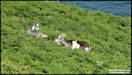
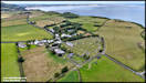
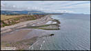
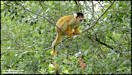
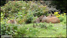
     29/7/25
On Sunday afternoon
we did a visit to the Wildlife Park in Ballaugh Curragh. We knew
that we had to renew our membership cards but were quite shocked to find
out that we hadn't paid a visit there on over 12 months! The highlight
for me was seeing the Golden Lion Tamarins actually venturing outside while
the public were there!
Panasonic TZ95 27/7/25
29/7/25
On Sunday afternoon
we did a visit to the Wildlife Park in Ballaugh Curragh. We knew
that we had to renew our membership cards but were quite shocked to find
out that we hadn't paid a visit there on over 12 months! The highlight
for me was seeing the Golden Lion Tamarins actually venturing outside while
the public were there!
Panasonic TZ95 27/7/25
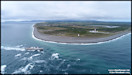
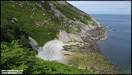
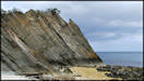
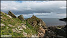
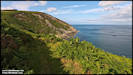
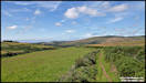
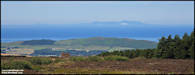
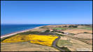
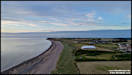
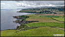
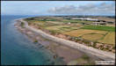
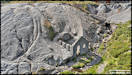
    30/7/25
A little trip up to
the north yesterday afternoon! I had a task in Douglas but then thought
I would head up to The Ayres for some aerial photography, but diverted
en-route to the interesting location of Blue Point, after which I realised
that I didn't have the time spare to continue onwards. Blue Point
is interesting from a geological point of view as it has an 'abandoned
cliff line' running inland from the sea, apparently a glacial feature from
the Devensian Period, around 115,000 to 11,700 years ago!
DJI Air 2S 29/7/25
30/7/25
A little trip up to
the north yesterday afternoon! I had a task in Douglas but then thought
I would head up to The Ayres for some aerial photography, but diverted
en-route to the interesting location of Blue Point, after which I realised
that I didn't have the time spare to continue onwards. Blue Point
is interesting from a geological point of view as it has an 'abandoned
cliff line' running inland from the sea, apparently a glacial feature from
the Devensian Period, around 115,000 to 11,700 years ago!
DJI Air 2S 29/7/25
  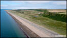 
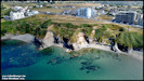
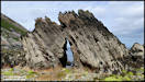
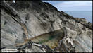
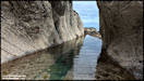
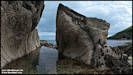
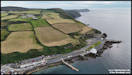
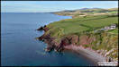
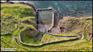
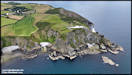
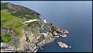
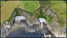
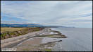
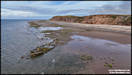
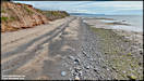
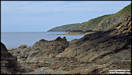
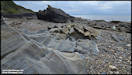
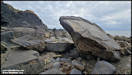
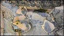
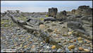
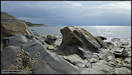
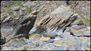
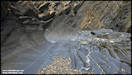
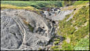
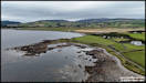
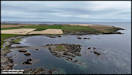
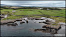
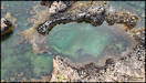
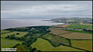
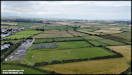
  31/7/25
Some low level aerial
photography at Poyll Vaaish yesterday afternoon. The weather was
rather dull and grey, but I think that if anything it added to the ambience
of the location. It was also high tide to a lot of the extensive
rock shelves were under water.
DJI Mini 4 Pro 30/7/25
31/7/25
Some low level aerial
photography at Poyll Vaaish yesterday afternoon. The weather was
rather dull and grey, but I think that if anything it added to the ambience
of the location. It was also high tide to a lot of the extensive
rock shelves were under water.
DJI Mini 4 Pro 30/7/25
 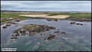  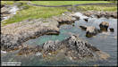 
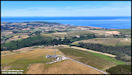
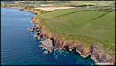
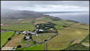
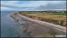
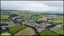
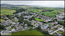
 Moving on to a second
location. I've been feeling for a long time that I should take some
aerial shots at Colby, so decided to see what I could achieve.
Not a great day for
it weather wise, so I need to go back again sometime when it's sunnier!
DJI Mini 4 Pro 30/7/25
Moving on to a second
location. I've been feeling for a long time that I should take some
aerial shots at Colby, so decided to see what I could achieve.
Not a great day for
it weather wise, so I need to go back again sometime when it's sunnier!
DJI Mini 4 Pro 30/7/25
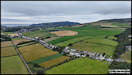    
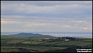
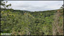
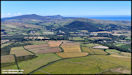
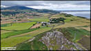
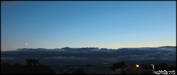
   1/8/25
A picture that I shot
from home a few days ago, looking out towards South Barrule, but with low
cloud covering the hills.
Insta360 Ace Pro
29/7/25
1/8/25
A picture that I shot
from home a few days ago, looking out towards South Barrule, but with low
cloud covering the hills.
Insta360 Ace Pro
29/7/25
|