4/7/24
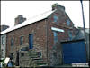
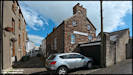
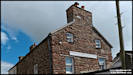
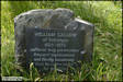
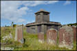
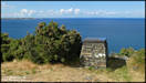
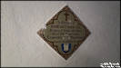
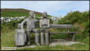
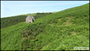
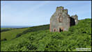
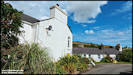
As an enthusiast of
maps, charts and navigation generally, this building has fascinated me
since I first saw it, probably in the 1990s when I'd first moved to the
island. Information on 'Gawne's School of Navigation' seemed impossible
to find back then, but nowadays there is a small article on the Culture
Vannin website. It was run from the 1820s to the 1850s by John Gawne to
teach young men the skills of nautical navigation. The building was
very run down for many years but now seems to have been renovated as a
private residence and has a new sign on the side.
Fuji Finepix S602 &
Insta360 Ace Pro 27/7/03 & 3/7/24
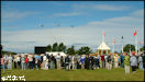
  5/7/24
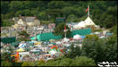
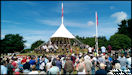
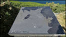
Happy Tynwald Day from
Island Images! These pictures were taken twenty and ten years ago.
5/7/24
Happy Tynwald Day from
Island Images! These pictures were taken twenty and ten years ago.
    6/7/24
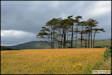
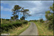
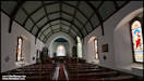
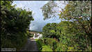
On Thursday afternoon
I had a photography expedition out and and visited three ancient burial
grounds! For a change I ditched the compact and bridge cameras and
took my Nikon DSLR. I normally either take of crop pictures into
a 16:9 format which works well on most computer screens, but I've left
these in the native 6:4 of the camera. I used the wide angle lens
of the Ace Pro for the Maughold Church interior shots though.
Nikon D7100 & Insta360
Ace Pro 4/7/24
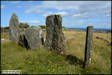
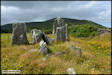
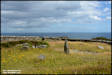
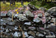
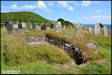
Cashtal-yn-Ard.
A Neolithic burial site
dating back to around 3,000 BC.
6/7/24
On Thursday afternoon
I had a photography expedition out and and visited three ancient burial
grounds! For a change I ditched the compact and bridge cameras and
took my Nikon DSLR. I normally either take of crop pictures into
a 16:9 format which works well on most computer screens, but I've left
these in the native 6:4 of the camera. I used the wide angle lens
of the Ace Pro for the Maughold Church interior shots though.
Nikon D7100 & Insta360
Ace Pro 4/7/24
Cashtal-yn-Ard.
A Neolithic burial site
dating back to around 3,000 BC.
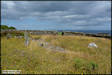
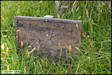
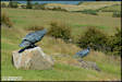
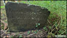
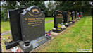
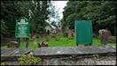
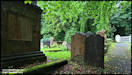
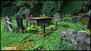
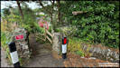
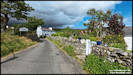
 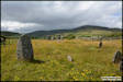 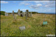   Moving on to Ballafayle
and the sun had re-emerged by the time I arrived! There are two burial
sites here, to the east of the lane there is another Neolithic burial site
and on the other side a much later Quaker burial ground, dating from the
1600s.
Moving on to Ballafayle
and the sun had re-emerged by the time I arrived! There are two burial
sites here, to the east of the lane there is another Neolithic burial site
and on the other side a much later Quaker burial ground, dating from the
1600s.
   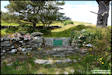 
  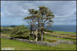  
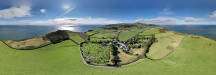
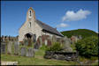
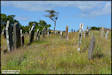
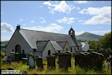
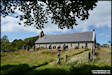
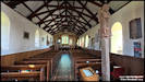
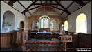
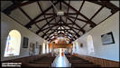
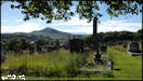
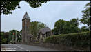
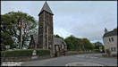
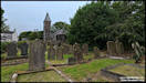
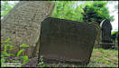
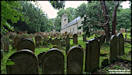
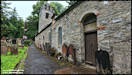
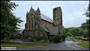
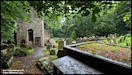
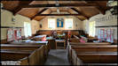
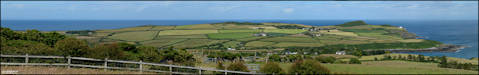 Maughold Church
The origins of this
site date back to the early days of Christianity on the island, and a monastery
was established here between 500 and 600 AD, lasting until 1299 when it
seems to have been taken over by Furness Abbey in England and probably
moved across the water. There are the remains of three Keeils visible
in the churchyard whose boundary walls denote the extent of the original
religious establishment. The church itself has been rebuild and modified
considerably (it probably started life as another keeil) although there
are a couple of parts that have been dated back to the 1100s AD.
I have an Aerial Panorama
of the area shot in September 2020 that shows the church and keeil sites:
Maughold Church
The origins of this
site date back to the early days of Christianity on the island, and a monastery
was established here between 500 and 600 AD, lasting until 1299 when it
seems to have been taken over by Furness Abbey in England and probably
moved across the water. There are the remains of three Keeils visible
in the churchyard whose boundary walls denote the extent of the original
religious establishment. The church itself has been rebuild and modified
considerably (it probably started life as another keeil) although there
are a couple of parts that have been dated back to the 1100s AD.
I have an Aerial Panorama
of the area shot in September 2020 that shows the church and keeil sites:
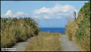
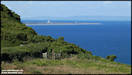
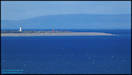
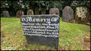
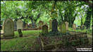
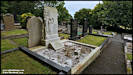
    8/7/24
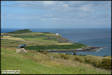
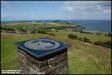
On Saturday afternoon
I had another visit to Maughold, mainly to check some grave details in
the churchyard for a friend 'across' but afterwards had a stroll along
the maughold brooghs and to the top of Maughold Head.
Panasonic FZ82
6/7/24
8/7/24
On Saturday afternoon
I had another visit to Maughold, mainly to check some grave details in
the churchyard for a friend 'across' but afterwards had a stroll along
the maughold brooghs and to the top of Maughold Head.
Panasonic FZ82
6/7/24
 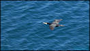  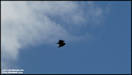 
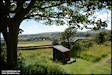
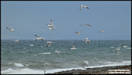
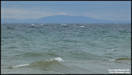
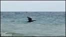
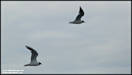
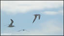
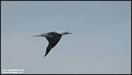
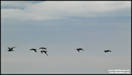
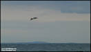
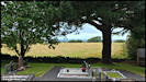
     9/7/24
Three fairly random
pictures taken yesterday afternoon.
Panasonic FZ82 8/7/24
9/7/24
Three fairly random
pictures taken yesterday afternoon.
Panasonic FZ82 8/7/24


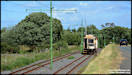
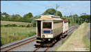
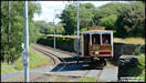
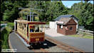
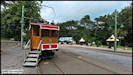
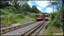
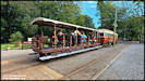
 There are five new Railway
pictures in Railways 2024 Pt1. Trams on the Manx Electric Railway.
Nikon D7100 4/7/24
There are five new Railway
pictures in Railways 2024 Pt1. Trams on the Manx Electric Railway.
Nikon D7100 4/7/24
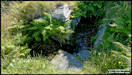
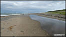
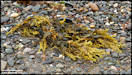
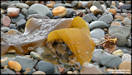
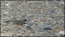
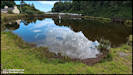
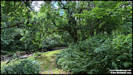
     13/7/24
On Thursday afternoon
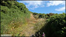
I visited the Cronk-y-Bing nature reserve on the west coast of the island,
just north of Jurby. I can't believe that I've never actually bee
inside it before, bu from the outside it just looks like a set of Marram
grass covered dunes, but I found a lot of things to photograph so quite
a big image set! As mentioned in previous posts, my plant identification
is very poor so most will be up to you!
Panasonic FZ82
11/7/24
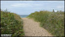
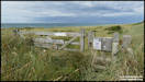
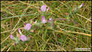
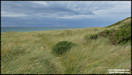
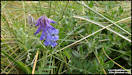
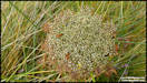
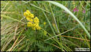
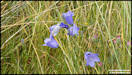
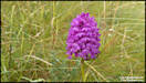
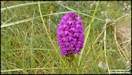
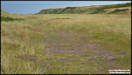
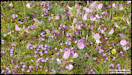
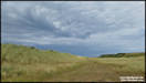
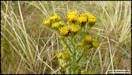
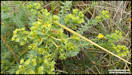
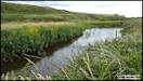
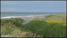
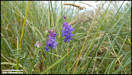
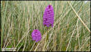
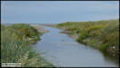
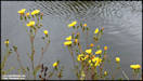
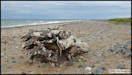
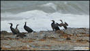
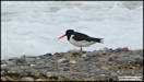
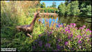
13/7/24
On Thursday afternoon
I visited the Cronk-y-Bing nature reserve on the west coast of the island,
just north of Jurby. I can't believe that I've never actually bee
inside it before, bu from the outside it just looks like a set of Marram
grass covered dunes, but I found a lot of things to photograph so quite
a big image set! As mentioned in previous posts, my plant identification
is very poor so most will be up to you!
Panasonic FZ82
11/7/24
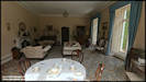
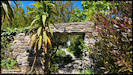
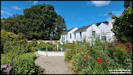
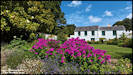
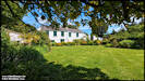
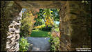
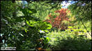
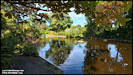
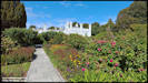
 15/7/24
A visit to Milntown
House on Friday, for lunch and a stroll around the gardens.
Insta360 Ace Pro 12/7/24
15/7/24
A visit to Milntown
House on Friday, for lunch and a stroll around the gardens.
Insta360 Ace Pro 12/7/24
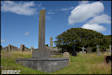
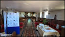
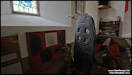
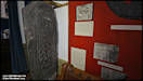
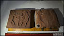
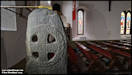
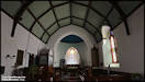
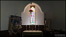
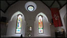
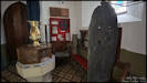
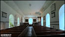
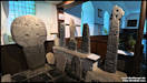
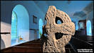
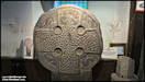
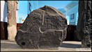
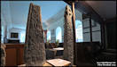
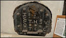
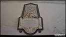
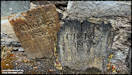
    21/7/24
I've driven past Bride
Church on numerous occasions over the years, and even stopped to photographic
from the outside and from the air, but I'd never even stepped inside the
churchyard. I rectified that on Friday afternoon and it proved to
have a fascinating interior with some ancient crosses on display.
Insta360 Ace Pro 19/7/24
21/7/24
I've driven past Bride
Church on numerous occasions over the years, and even stopped to photographic
from the outside and from the air, but I'd never even stepped inside the
churchyard. I rectified that on Friday afternoon and it proved to
have a fascinating interior with some ancient crosses on display.
Insta360 Ace Pro 19/7/24
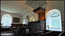
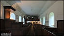
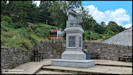
   23/7/24
Another church visit,
this time to Braddan Old Church, which was rebuilt in 1777 and later
replaced by the 'new' church which was consecrated in 1876.
Insta360 Ace Pro 20/7/24
23/7/24
Another church visit,
this time to Braddan Old Church, which was rebuilt in 1777 and later
replaced by the 'new' church which was consecrated in 1876.
Insta360 Ace Pro 20/7/24
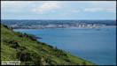
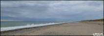
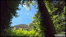
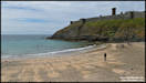
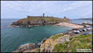
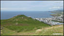
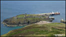
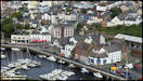
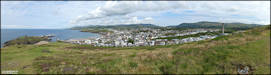
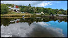
     25/7/24
The weather this summer
has been rather disappointing, with cloudy, windy, rainy, or a combination
of all three, being more common than sunny calm days. However, last
Sunday afternoon the sun shone and I took a walk around and over Peel Hill.
Panasonic FZ82
21/7/24
25/7/24
The weather this summer
has been rather disappointing, with cloudy, windy, rainy, or a combination
of all three, being more common than sunny calm days. However, last
Sunday afternoon the sun shone and I took a walk around and over Peel Hill.
Panasonic FZ82
21/7/24
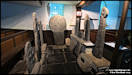
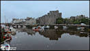
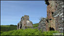
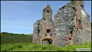
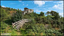
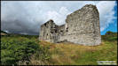
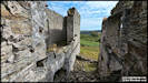
 26/7/24
A tale of three plans!
Plan A was to do some aerial photography in the Castletown area during
one of the regular times that the airport is closed due to an ongoing shortage
of Air Traffic Controllers. The weather was OK at home but down at
Castletown there was low cloud and rain, which precluded any drone flying.
However I had Plan B, which was some general ground level photography around
Castletown. This was then spoiled when I found that I had left the SD card
for my FZ82 in the computer at home! Plan C was hatched, which was
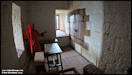
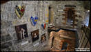
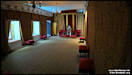
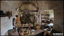
a photographic wander around Castle Rushen using the little Ace Pro.
Insta360 Ace Pro 22/7/24
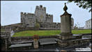
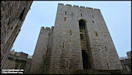
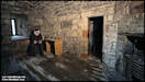
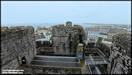
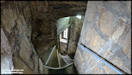
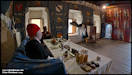
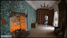
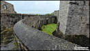
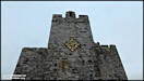
26/7/24
A tale of three plans!
Plan A was to do some aerial photography in the Castletown area during
one of the regular times that the airport is closed due to an ongoing shortage
of Air Traffic Controllers. The weather was OK at home but down at
Castletown there was low cloud and rain, which precluded any drone flying.
However I had Plan B, which was some general ground level photography around
Castletown. This was then spoiled when I found that I had left the SD card
for my FZ82 in the computer at home! Plan C was hatched, which was
a photographic wander around Castle Rushen using the little Ace Pro.
Insta360 Ace Pro 22/7/24
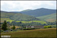
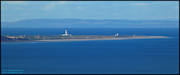
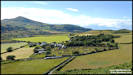
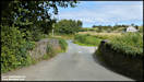
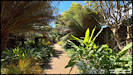
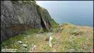
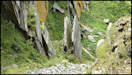
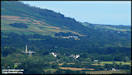
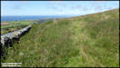
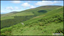
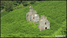
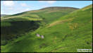
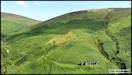
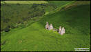
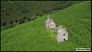
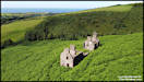
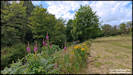
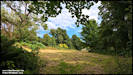
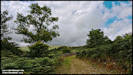
     27/7/24
I'm still playing catch-up
on pictures I've taken! These are from last Tuesday afternoon, which
was a lovely sunny and warm day so I decided to do a walk in the countryside.
My plan was to start from Sartfield (in the hills above Kirkmichael) and
walk down to the old slate quarry at Glion Kiark, before continuing on
the the old lead mines in the valley of Ballalinnag, in the event it didn't
quite work out, for reasons that I should have predicted ahead of time!
Panasonic TZ60 &
DJI Mini 2 23/7/24
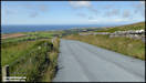
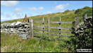
27/7/24
I'm still playing catch-up
on pictures I've taken! These are from last Tuesday afternoon, which
was a lovely sunny and warm day so I decided to do a walk in the countryside.
My plan was to start from Sartfield (in the hills above Kirkmichael) and
walk down to the old slate quarry at Glion Kiark, before continuing on
the the old lead mines in the valley of Ballalinnag, in the event it didn't
quite work out, for reasons that I should have predicted ahead of time!
Panasonic TZ60 &
DJI Mini 2 23/7/24
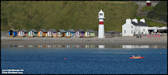
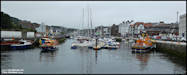
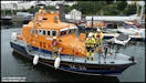
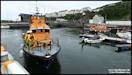
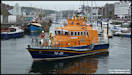
    28/7/24
On Wednesday afternoon
I was waiting in a queue of traffic on the South Quay in Douglas, waiting
for the lifting bridge to open. I saw that the vessel entering was
one of our island RNLI lifeboats, so after crossing I parked the car up
and went to get some pictures, only to find that there were in fact two
lifeboats in the inner harbour area. They had rescued a small
boat that had suffered engine failure and towed it back to safety in the
harbour.
Panasonic FZ82 24/7/24
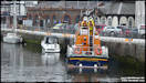
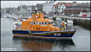
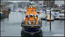
28/7/24
On Wednesday afternoon
I was waiting in a queue of traffic on the South Quay in Douglas, waiting
for the lifting bridge to open. I saw that the vessel entering was
one of our island RNLI lifeboats, so after crossing I parked the car up
and went to get some pictures, only to find that there were in fact two
lifeboats in the inner harbour area. They had rescued a small
boat that had suffered engine failure and towed it back to safety in the
harbour.
Panasonic FZ82 24/7/24
    The day after I took
the lifeboat pictures, I captured these images of the Steam Packet's 'Ben-my-Chree'
and 'Manxman' on approach to Douglas.
Panasonic FZ82 25/7/24
The day after I took
the lifeboat pictures, I captured these images of the Steam Packet's 'Ben-my-Chree'
and 'Manxman' on approach to Douglas.
Panasonic FZ82 25/7/24
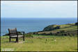
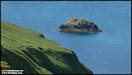
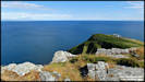
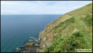
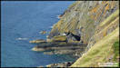
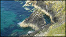
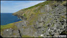
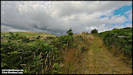
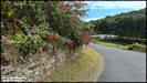
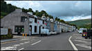
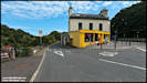
  30/7/24
On Saturday afternoon
I went out for what was intended as just a little stroll around Laxey,
due to some threatening looking clouds over the hills, but in the end I
walked up to Agneash and back!
Insta360 Ace Pro 27/7/24
30/7/24
On Saturday afternoon
I went out for what was intended as just a little stroll around Laxey,
due to some threatening looking clouds over the hills, but in the end I
walked up to Agneash and back!
Insta360 Ace Pro 27/7/24
    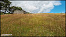
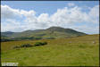
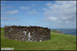
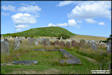
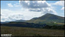
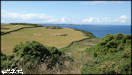
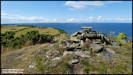
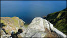
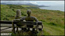
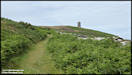
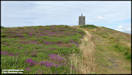
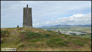
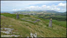
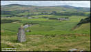
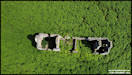
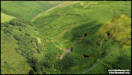
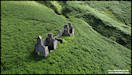
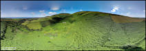
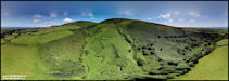
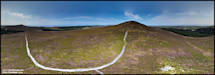
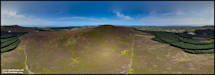
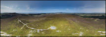
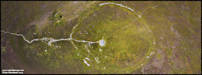
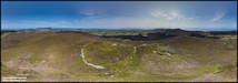
     31/7/24
Despite being able to
view it from my house, it isn't often that I actually take a walk up the
hill of South Barrule. Rising to a height of 1,437 ft above sea level,
it around a 500 ft walk up from where you can park. At the top are
the remains of an ancient hill fort dating back to around 500 BC which
consisted of numerous round houses enclosed with in huge stone defensive
wall. I would normally have taken some ground level pictures on the
walk, but my conventional camera refused to write onto the memory card
so I was just left with shooting aerial pictures with the drone.
I flew from two locations and shot these five panoramas.
Culture Vannin have
a very interesting article including an excellent video by Charles Guard
explaining the site available
here.
Don't forget to click
on the larger images to access the interactive versions.
DJI Mini 2 30/7/24
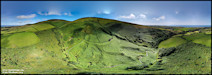
31/7/24
Despite being able to
view it from my house, it isn't often that I actually take a walk up the
hill of South Barrule. Rising to a height of 1,437 ft above sea level,
it around a 500 ft walk up from where you can park. At the top are
the remains of an ancient hill fort dating back to around 500 BC which
consisted of numerous round houses enclosed with in huge stone defensive
wall. I would normally have taken some ground level pictures on the
walk, but my conventional camera refused to write onto the memory card
so I was just left with shooting aerial pictures with the drone.
I flew from two locations and shot these five panoramas.
Culture Vannin have
a very interesting article including an excellent video by Charles Guard
explaining the site available
here.
Don't forget to click
on the larger images to access the interactive versions.
DJI Mini 2 30/7/24
|