|
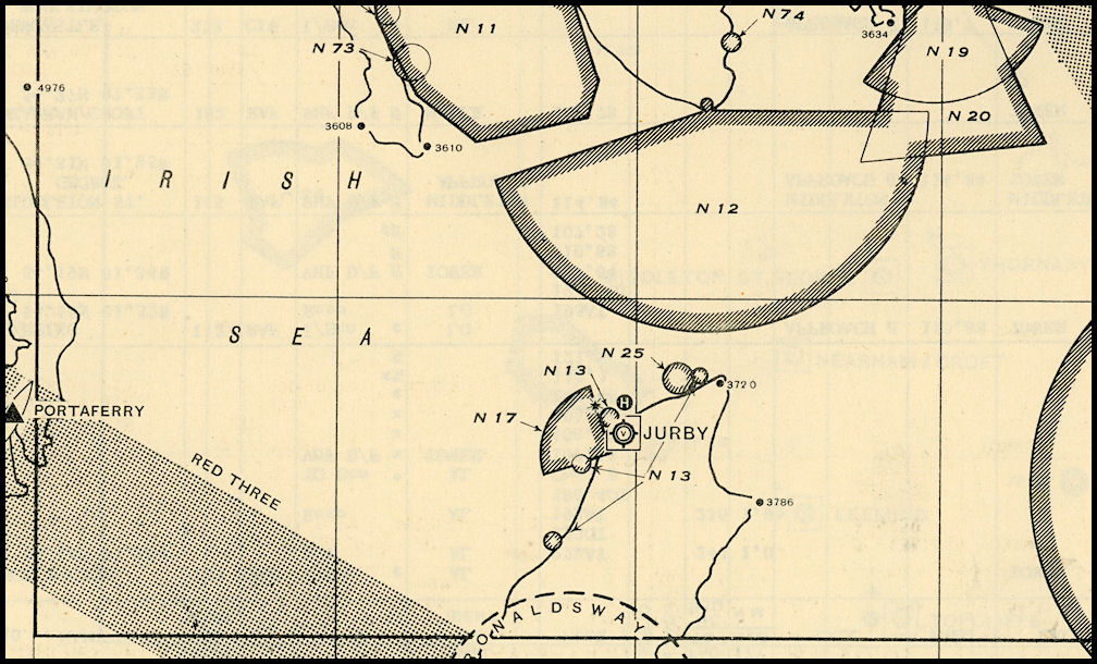
A
section of the Solway Firth chart from the Dec 1951 RAF Radio Facilities
Charts handbook. Jurby shown surrounded by various Danger Areas. N17 is
air/ground and ground/air firing up to 15,000ft. N13 is bombing up to 25,000ft.
N25 bombing up to 14,000ft, all shown as RAF Jurby Ranges. N12 is the Army
Burrow Head range with artillery firing up to 60,000ft. Ronaldsway Control
Zone shown to the south.
|