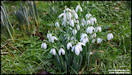
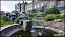
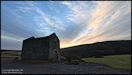
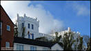
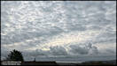
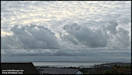
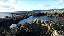
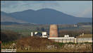
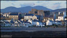
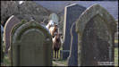
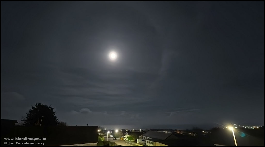
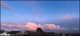
2/2/24
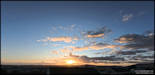
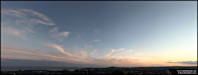
A pre-sunrise sky on
Imbolc, just taken out of the window at home.
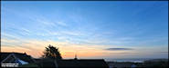 Yesterday was the ancient
Celtic festival of Imbolc, marking the mid point between the Winter Solstice
and Spring Equinox when the first plants of spring can be seen emerging
from winter hibernation. It was associated with the goddess Brigid, later
converted for Christianity to St Brigid's Day.
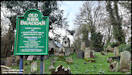
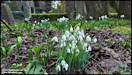
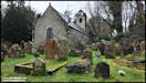
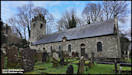
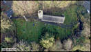
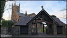
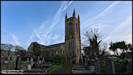
It has become a bit
of an Island Images tradition in recent years for me to visit Old Kirk
Braddan to photograph the snowdrops growing in the churchyard, although
I seem to have missed it last year, probably due to weather issues!
DJI Osmo Pocket 3 &
Mini 2 1/2/24
Yesterday was the ancient
Celtic festival of Imbolc, marking the mid point between the Winter Solstice
and Spring Equinox when the first plants of spring can be seen emerging
from winter hibernation. It was associated with the goddess Brigid, later
converted for Christianity to St Brigid's Day.
It has become a bit
of an Island Images tradition in recent years for me to visit Old Kirk
Braddan to photograph the snowdrops growing in the churchyard, although
I seem to have missed it last year, probably due to weather issues!
DJI Osmo Pocket 3 &
Mini 2 1/2/24

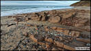
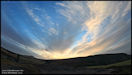
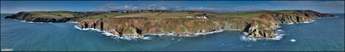
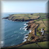
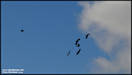
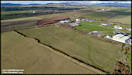
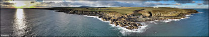
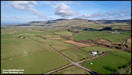
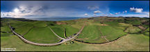
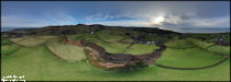
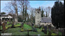     An aerial perspective
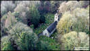    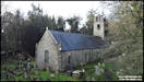
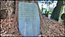
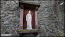
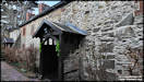
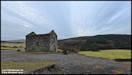
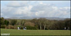
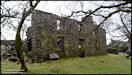
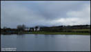
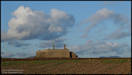
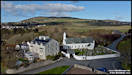
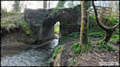
  3/2/24
I ran out of time for
producing webpages yesterday morning and had other tasks in the afternoon,
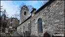
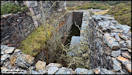
but after leaving Old Kirk Braddan I headed west to Crosby to visit another
site with connections to the first of February, Keeil Vreeshey, or St Bridget's
Chapel. A typical keeil dating to the early days of Christianity
in the Isle of Man and dedicated to St Bridget. Bridget was an Irish
nun who supposedly founded a nunnery at Kildare, Ireland, before travelling
to the Isle of Man and founding a nunnery here just outside Douglas, at
the location now just known as The Nunnery. There is a holy well
dedicated to St Bridget close to The Nunnery.
DJI Mini 2 1/2/24
3/2/24
I ran out of time for
producing webpages yesterday morning and had other tasks in the afternoon,
but after leaving Old Kirk Braddan I headed west to Crosby to visit another
site with connections to the first of February, Keeil Vreeshey, or St Bridget's
Chapel. A typical keeil dating to the early days of Christianity
in the Isle of Man and dedicated to St Bridget. Bridget was an Irish
nun who supposedly founded a nunnery at Kildare, Ireland, before travelling
to the Isle of Man and founding a nunnery here just outside Douglas, at
the location now just known as The Nunnery. There is a holy well
dedicated to St Bridget close to The Nunnery.
DJI Mini 2 1/2/24
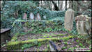
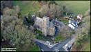
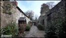
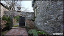
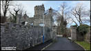
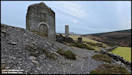
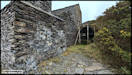
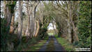
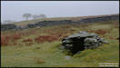
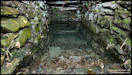
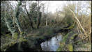
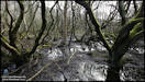
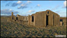
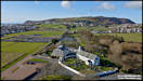
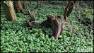
     4/2/24
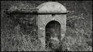
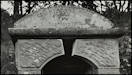
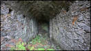
After taking the pictures
of Keeil Vreeshey, I became aware of the existence of a 'Holy Well' also
dedicated to St Bridget and I though that I'd try to find it. It
was in Douglas, fairly close to The Nunnery and was apparently visited
by pilgrims for the healing properties of it's water. Water from
it was also used for baptismal purposes at the parish church. It
seems to have fallen into a bit of a decline, but was restored in 1910.
Unfortunately a tree fell on it around 2007 and caused major damage.
No attempts seem to have been made to repair it and It gradually vanished
into the undergrowth. Spoiler alert - I didn't manage to find it,
but had a nice walk there and around the Nunnery grounds. I did however,
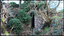
discover another structure hidden in the undergrowth!
DJI Osmo Pocket 3 3/2/24
4/2/24
After taking the pictures
of Keeil Vreeshey, I became aware of the existence of a 'Holy Well' also
dedicated to St Bridget and I though that I'd try to find it. It
was in Douglas, fairly close to The Nunnery and was apparently visited
by pilgrims for the healing properties of it's water. Water from
it was also used for baptismal purposes at the parish church. It
seems to have fallen into a bit of a decline, but was restored in 1910.
Unfortunately a tree fell on it around 2007 and caused major damage.
No attempts seem to have been made to repair it and It gradually vanished
into the undergrowth. Spoiler alert - I didn't manage to find it,
but had a nice walk there and around the Nunnery grounds. I did however,
discover another structure hidden in the undergrowth!
DJI Osmo Pocket 3 3/2/24
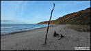
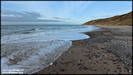
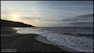
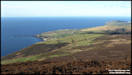
    5/2/24
I wouldn't normally
do two photo trips in the same day, but with the weather forecast showing
unsettled over the next few days I headed out again on Saturday afternoon,
this time over to the west coast to visit the lovely beach at Whitestrand,
between Peel and Kirkmichael.
Insta360 Ace Pro &
Panasonic TZ200 3/2/24
5/2/24
I wouldn't normally
do two photo trips in the same day, but with the weather forecast showing
unsettled over the next few days I headed out again on Saturday afternoon,
this time over to the west coast to visit the lovely beach at Whitestrand,
between Peel and Kirkmichael.
Insta360 Ace Pro &
Panasonic TZ200 3/2/24
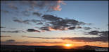
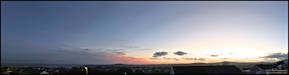
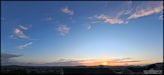
     Some lovely colours
in the sky to the south west after I'd arrived home.
Insta360 Ace Pro 3/2/24
Some lovely colours
in the sky to the south west after I'd arrived home.
Insta360 Ace Pro 3/2/24
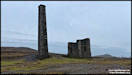
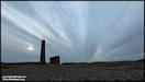
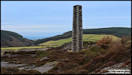
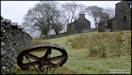
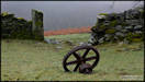
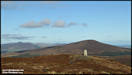
 8/2/24
On Tuesday afternoon
I headed off the the old mines, up in the hills above Foxdale. I
was hoping that the clouds would clear from a rather dull grey morning,
but unfortunately that only happened at around sunset!
Insta360 Ace Pro 6/2/24
8/2/24
On Tuesday afternoon
I headed off the the old mines, up in the hills above Foxdale. I
was hoping that the clouds would clear from a rather dull grey morning,
but unfortunately that only happened at around sunset!
Insta360 Ace Pro 6/2/24
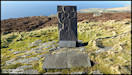
     9/2/24
Wednesday morning was
bright and sunny, but with poor weather forecast for the following days
I decided to make the most of it and set out for a visit to the Fairy Bridge.
Not that one on the way to and from the airport, but the 'real' one near
Kewaigue. I also decided to use a 'real' camera!
Nikon D7100 7/2/24
9/2/24
Wednesday morning was
bright and sunny, but with poor weather forecast for the following days
I decided to make the most of it and set out for a visit to the Fairy Bridge.
Not that one on the way to and from the airport, but the 'real' one near
Kewaigue. I also decided to use a 'real' camera!
Nikon D7100 7/2/24
 10/2/24
In addition to the still
pictures at the Fairy Bridge, I've also produced two videos. The
first one was shot on the day of my recent visit and is just a short composition
of video clips with no commentary, in real time and slow motion.
The second one is a compilation of still images that I've taken there over
the years since my first visit in 2000, plus a couple of older ones from
the late 1800s and early 1900s, courtesy of Manx National Heritage at the
iMuseum.
Click a button below
to view on YouTube.
10/2/24
In addition to the still
pictures at the Fairy Bridge, I've also produced two videos. The
first one was shot on the day of my recent visit and is just a short composition
of video clips with no commentary, in real time and slow motion.
The second one is a compilation of still images that I've taken there over
the years since my first visit in 2000, plus a couple of older ones from
the late 1800s and early 1900s, courtesy of Manx National Heritage at the
iMuseum.
Click a button below
to view on YouTube.
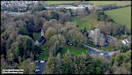
  11/2/24
Yesterday morning was
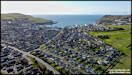
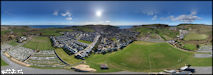
sunny and calm and I set out to try and shoot a video project that I had
been thinking about since visiting the Fairy Bridge a few days ago.
Although it wasn't really part of the project (but might get included!)
I took the mini drone along and took these aerial shots of Oakhill and
Keristal.
DJI Mini 2 10/2/24
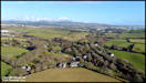
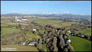
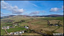
11/2/24
Yesterday morning was
sunny and calm and I set out to try and shoot a video project that I had
been thinking about since visiting the Fairy Bridge a few days ago.
Although it wasn't really part of the project (but might get included!)
I took the mini drone along and took these aerial shots of Oakhill and
Keristal.
DJI Mini 2 10/2/24
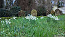
 12/2/24
Pictures taken from
home around sunset yesterday.
Insta360 Ace Pro &
Panasonic TZ200 11/2/24
12/2/24
Pictures taken from
home around sunset yesterday.
Insta360 Ace Pro &
Panasonic TZ200 11/2/24
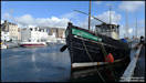
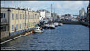
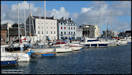
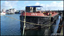
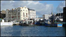
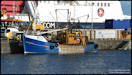
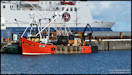
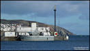
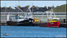
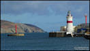
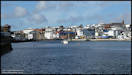
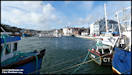
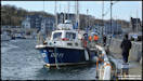
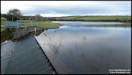
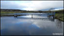
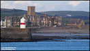
 13/2/24
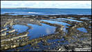
I took these pictures
around the midday yesterday on a walk around Douglas Harbour. The
weather forecast had mentioned another very high tide with the possibility
of some 'overtopping' at certain areas but I think the water levels remained
just below the quays.
Panasonic FZ82 13/2/24
13/2/24
I took these pictures
around the midday yesterday on a walk around Douglas Harbour. The
weather forecast had mentioned another very high tide with the possibility
of some 'overtopping' at certain areas but I think the water levels remained
just below the quays.
Panasonic FZ82 13/2/24
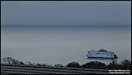
  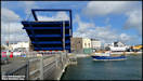   14/2/24
Happy St Valentines
Day! - which probably dates back to the pre Christian Roman festival
of Lupercalia which was celebrated from the 13th to 14th.
The following pictures
have one thing in common, the Isle of Man Steam Packet's new vessel 'Manxman',
captured over two days. All of the pictures were taken from my house,
so probably at a distance of around two miles from me to the ship.
Equivalent focal lengths from 16mm to 973mm.
Panasonic FZ82 &
Insta360 Ace Pro 12/2/24 & 13/2/24 (Last picture 14/2/24)
14/2/24
Happy St Valentines
Day! - which probably dates back to the pre Christian Roman festival
of Lupercalia which was celebrated from the 13th to 14th.
The following pictures
have one thing in common, the Isle of Man Steam Packet's new vessel 'Manxman',
captured over two days. All of the pictures were taken from my house,
so probably at a distance of around two miles from me to the ship.
Equivalent focal lengths from 16mm to 973mm.
Panasonic FZ82 &
Insta360 Ace Pro 12/2/24 & 13/2/24 (Last picture 14/2/24)
 
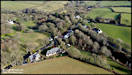
 15/2/24
A new video, shot around
the Oakhill and Keristal areas, south of Douglas. This was really
created with a long term friend in mind. Stewart was one of the first
people to contact me way back, when I'd first started my Isle of Man based
photo website in the late 1990s and we have stayed in contact ever since.
Although living in the UK, he has IOM family connections and has visited
regularly since he was a child, particularly in this area, so I though
that I'd make him this little video.
DJI Osmo Pocket 3 &
DJI Mini 2 10/2/24
15/2/24
A new video, shot around
the Oakhill and Keristal areas, south of Douglas. This was really
created with a long term friend in mind. Stewart was one of the first
people to contact me way back, when I'd first started my Isle of Man based
photo website in the late 1990s and we have stayed in contact ever since.
Although living in the UK, he has IOM family connections and has visited
regularly since he was a child, particularly in this area, so I though
that I'd make him this little video.
DJI Osmo Pocket 3 &
DJI Mini 2 10/2/24
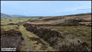
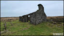
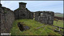
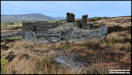
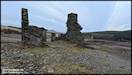
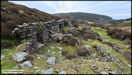
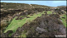
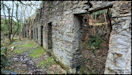
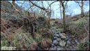
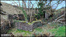
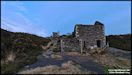
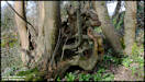
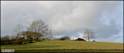
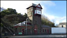
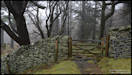
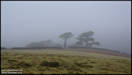
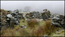
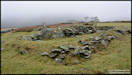
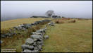
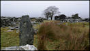
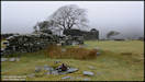
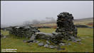
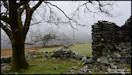
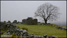
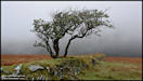
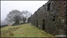
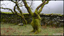
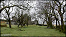
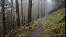
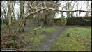
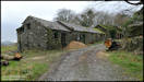
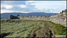
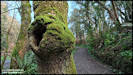
 16/2/24
Yesterday was not a
good weather day, with low cloud down to sea level in the morning and quite
heavy rain. The rain eased off in the afternoon and as I fancied
a bit of exercise I headed up into the hills for a wander around the tholtans
above Tholt-y-Will. The rain had more or less stopped when I arrived
there and the cloud base had lifted to being up and down around ground
level there, which is up to 700ft above sea level.
Nikon D7100 15/2/23
16/2/24
Yesterday was not a
good weather day, with low cloud down to sea level in the morning and quite
heavy rain. The rain eased off in the afternoon and as I fancied
a bit of exercise I headed up into the hills for a wander around the tholtans
above Tholt-y-Will. The rain had more or less stopped when I arrived
there and the cloud base had lifted to being up and down around ground
level there, which is up to 700ft above sea level.
Nikon D7100 15/2/23
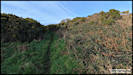
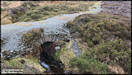
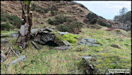
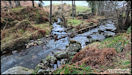
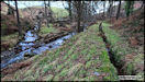
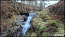
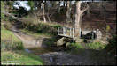
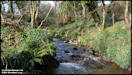
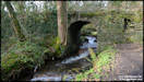
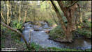
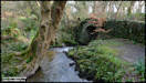
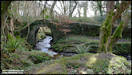
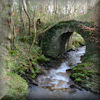
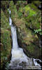
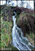
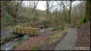
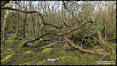
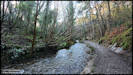
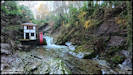
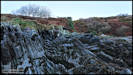
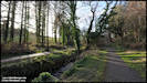
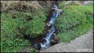
     17/2/24
After my stroll around
the tholtans above Tholt-y-Will, I headed back into the glen to view the
Alt Waterfall.
Nikon D7100 & DJI
Osmo Pocket 3 15/2/23
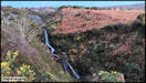
17/2/24
After my stroll around
the tholtans above Tholt-y-Will, I headed back into the glen to view the
Alt Waterfall.
Nikon D7100 & DJI
Osmo Pocket 3 15/2/23
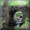
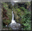
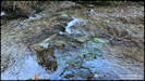
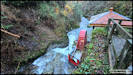
  A full frame image
and a short video of the waterfall.
A full frame image
and a short video of the waterfall.
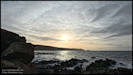
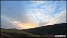
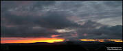
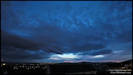
 A dramatic sunset sky
after a dull and misty day, shot from home.
Panasonic TZ200 15/2/24
A dramatic sunset sky
after a dull and misty day, shot from home.
Panasonic TZ200 15/2/24
 18/2/24
A few pictures taken
during a walk from home on Friday afternoon.
Panasonic FZ82 16/2/24
18/2/24
A few pictures taken
during a walk from home on Friday afternoon.
Panasonic FZ82 16/2/24
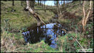
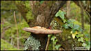
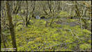
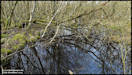
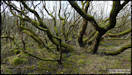
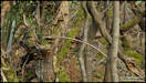
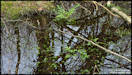
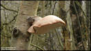
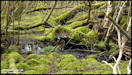
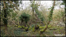
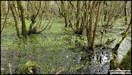
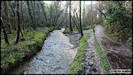
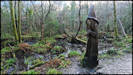
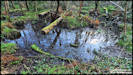
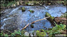
     19/2/24
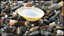
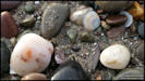
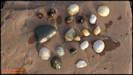
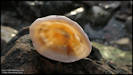
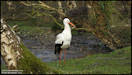
I took these pictures
walking yesterday afternoon in the Ballaugh Curragh wetlands area.
In fact they were all taken from the Wildlife Park's nature walk, where
a boardwalk keeps you feet dry as you walk through the curragh.
Panasonic FZ82
18/2/24
19/2/24
I took these pictures
walking yesterday afternoon in the Ballaugh Curragh wetlands area.
In fact they were all taken from the Wildlife Park's nature walk, where
a boardwalk keeps you feet dry as you walk through the curragh.
Panasonic FZ82
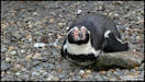
18/2/24
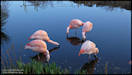
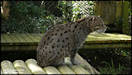
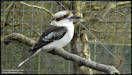
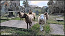
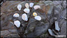
  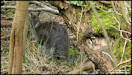  A few animal pictures
inside the Wildlife Park.
A few animal pictures
inside the Wildlife Park.
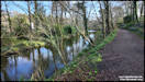
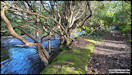
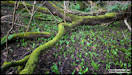
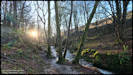
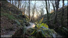
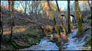
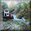
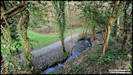
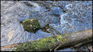
     21/2/24
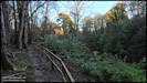
After another very wet
morning, the weather cleared at around 3-30 in the afternoon and I went
out for a walk in nearby Groudle Glen.
Insta360 Ace Pro 20/2/24
21/2/24
After another very wet
morning, the weather cleared at around 3-30 in the afternoon and I went
out for a walk in nearby Groudle Glen.
Insta360 Ace Pro 20/2/24
    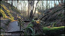
 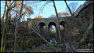 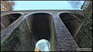 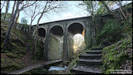 
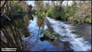
     The Groudle Glen video
is has now been edited and published. It's just a short stroll along
the river from the waterwheel to the viaduct.
Click the button below
to view it on YouTube
The Groudle Glen video
is has now been edited and published. It's just a short stroll along
the river from the waterwheel to the viaduct.
Click the button below
to view it on YouTube
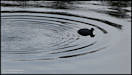
 22/2/24
A little sequence I
shot yesterday afternoon of an aircraft passing the moon. I'd noticed
the almost full moon in the sky and saw a few aircraft vapour trails heading
towards that area of the sky. I grabbed a camera, hoping that one
might cross right across the moon's disk, but this was the closest I could
manage! The aircraft was British Airways Boeing 777-200 G-YMMR operating
a service from London Heathrow to Cincinnati 'Speedbird 21 Victor', at
37,000 ft.
Panasonic FZ82 21/2/24
22/2/24
A little sequence I
shot yesterday afternoon of an aircraft passing the moon. I'd noticed
the almost full moon in the sky and saw a few aircraft vapour trails heading
towards that area of the sky. I grabbed a camera, hoping that one
might cross right across the moon's disk, but this was the closest I could
manage! The aircraft was British Airways Boeing 777-200 G-YMMR operating
a service from London Heathrow to Cincinnati 'Speedbird 21 Victor', at
37,000 ft.
Panasonic FZ82 21/2/24
   Two sunsets and the
moon. These pictures were shot using three diferent cameras, but
are displayed in the correct time sequence.
DJI Osmo Pocket 3, Nikon
D7100, Insta 360 Ace Pro 21/2/24
Two sunsets and the
moon. These pictures were shot using three diferent cameras, but
are displayed in the correct time sequence.
DJI Osmo Pocket 3, Nikon
D7100, Insta 360 Ace Pro 21/2/24
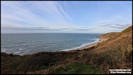
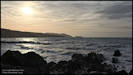
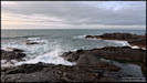
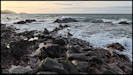
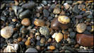
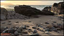
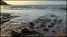
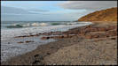
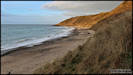
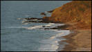
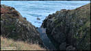
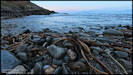
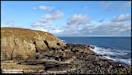
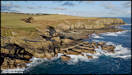
   23/2/24
I took these pictures
yesterday afternoon on a walk from the car park at Scarlett, following
the coastline to Pooil Vaaish and then back by the same route.
Panasonic FZ82 22/2/24
23/2/24
I took these pictures
yesterday afternoon on a walk from the car park at Scarlett, following
the coastline to Pooil Vaaish and then back by the same route.
Panasonic FZ82 22/2/24
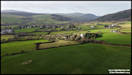
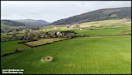
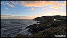
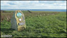
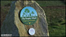
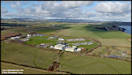
     24/2/24
Nice weather again yesterday
afternoon and as a bonus, the winds dropped down to a level suitable for
some aerial photography. I planned a circular walk from Port Grenaugh,
going initially through Arragon then up to Meary Veg, where I hoped to
get some aerial shots of the 'People's Wood'. Announced in 2019,
and planted with 85,000, mainly broad-leaved trees in 2021, it covers
113 acres. Apparently there has been a higher than expected failure
rate of the trees initially planted. There has been a lot of tree
planting in the area and I tried to find a map showing the 'People's Wood'
but without success.
Panasonic TZ200 &
DJI Mini 2 23/2/24
24/2/24
Nice weather again yesterday
afternoon and as a bonus, the winds dropped down to a level suitable for
some aerial photography. I planned a circular walk from Port Grenaugh,
going initially through Arragon then up to Meary Veg, where I hoped to
get some aerial shots of the 'People's Wood'. Announced in 2019,
and planted with 85,000, mainly broad-leaved trees in 2021, it covers
113 acres. Apparently there has been a higher than expected failure
rate of the trees initially planted. There has been a lot of tree
planting in the area and I tried to find a map showing the 'People's Wood'
but without success.
Panasonic TZ200 &
DJI Mini 2 23/2/24
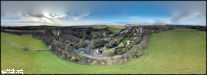
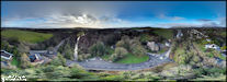
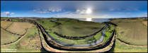
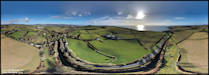
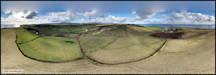
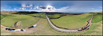
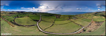
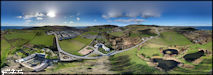
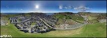
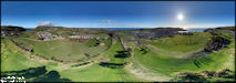
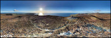
     Interactive 360 degree
Panoramas
Interactive 360 degree
Panoramas
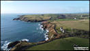
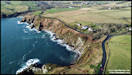
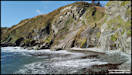
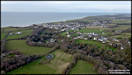
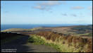
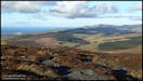
 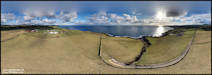 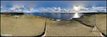 Coastal Views
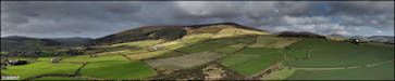
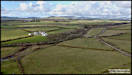
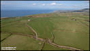
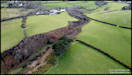
 27/2/24
You can find out lost
of interesting things from looking at maps and I use them a lot for finding
good locations for photography. Two sites that I had noticed marked
on the Outdoor Leisure map were 'Manannan's Chair' and 'Keeil Pharick'
both up on the high ground by the Staarvey Road near Cronk-y-Voddy. So
with some good drone flying weather on Sunday afternoon I set out to investigate,
only to find the Staarvey Road closed for installation of a new water main
right by Manannan's Chair! However, I was able to get close enough
to fly the drone there for some aerial shots. My new source of information
on ancient sites, 'A Guide to the Archaeological Sites of the Isle of Man,
unfortunately omits both sites, but I've found a bit of information on
internet searches.
DJI Air 2S 25/2/24
Manannan's Chair - A
semi-circular earthwork possibly from the Mesolithic or Neolithic period.
Use unknown but maybe part of a fortified farmstead.
27/2/24
You can find out lost
of interesting things from looking at maps and I use them a lot for finding
good locations for photography. Two sites that I had noticed marked
on the Outdoor Leisure map were 'Manannan's Chair' and 'Keeil Pharick'
both up on the high ground by the Staarvey Road near Cronk-y-Voddy. So
with some good drone flying weather on Sunday afternoon I set out to investigate,
only to find the Staarvey Road closed for installation of a new water main
right by Manannan's Chair! However, I was able to get close enough
to fly the drone there for some aerial shots. My new source of information
on ancient sites, 'A Guide to the Archaeological Sites of the Isle of Man,
unfortunately omits both sites, but I've found a bit of information on
internet searches.
DJI Air 2S 25/2/24
Manannan's Chair - A
semi-circular earthwork possibly from the Mesolithic or Neolithic period.
Use unknown but maybe part of a fortified farmstead.
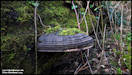
   Keeil Pharik - ancient
chapel. A bit different from other Keeil's as it's not actually
visible but located within a circular earthwork. When surveyed in
1910 the archaeologists found the remains of the keeil buried under the
earth with three lintel graves below the floor level. Now I know
I'm not an archaeologist but does this suggest an ancient pre-christian
burial mound that's just been hollowed out to build a chapel on?
Keeil Pharik - ancient
chapel. A bit different from other Keeil's as it's not actually
visible but located within a circular earthwork. When surveyed in
1910 the archaeologists found the remains of the keeil buried under the
earth with three lintel graves below the floor level. Now I know
I'm not an archaeologist but does this suggest an ancient pre-christian
burial mound that's just been hollowed out to build a chapel on?
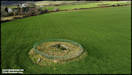
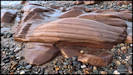
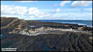
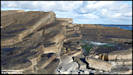
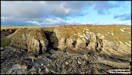
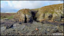
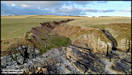
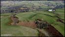
  28/2/24
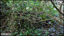
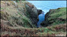
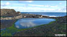
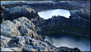
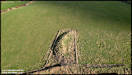
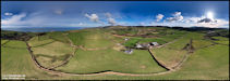
After carrying out the
aerial shots of Manannan's Chair and Keeil Pharick the plan was to continue
to the end of the road, park the car and walk down the greenway road into
Cooildarry. However, the tarmac road actually finished well
short of what is shown on the Outdoor Leisure map and there was nowhere
to park anywhere near the end! So in Plan B I drove around to Glen
Wyllin and walked up Cooildarry from the lower end. I hadn't really
intended any more aerial pics but took the mini drone in it's bag just
in case. In the end I walked up the green lane above Cooildarry and
found a nice spot to fly from. I was just intending to get some aerial
shots from over the glen, but instead discovered an amazing geological
feature that I'd never know existed before!
DJI Mini 2 25/2/24
28/2/24
After carrying out the
aerial shots of Manannan's Chair and Keeil Pharick the plan was to continue
to the end of the road, park the car and walk down the greenway road into
Cooildarry. However, the tarmac road actually finished well
short of what is shown on the Outdoor Leisure map and there was nowhere
to park anywhere near the end! So in Plan B I drove around to Glen
Wyllin and walked up Cooildarry from the lower end. I hadn't really
intended any more aerial pics but took the mini drone in it's bag just
in case. In the end I walked up the green lane above Cooildarry and
found a nice spot to fly from. I was just intending to get some aerial
shots from over the glen, but instead discovered an amazing geological
feature that I'd never know existed before!
DJI Mini 2 25/2/24
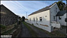
  On the way home I called
in at Kirk Michael and took these pics.
Insta360 Ace Pro &
Panasonic TZ60 25/2/24
On the way home I called
in at Kirk Michael and took these pics.
Insta360 Ace Pro &
Panasonic TZ60 25/2/24
     I took these three pictures
with the Ace pro from late afternoon to nightime. The camera does
really well in low light situations.
Insta360 Ace Pro 25/2/24
I took these three pictures
with the Ace pro from late afternoon to nightime. The camera does
really well in low light situations.
Insta360 Ace Pro 25/2/24
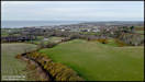
   29/2/24
Another aerial photography
expedition, this time to Port Erin, on Monday afternoon. I had a
specific target in mind that has a very interesting history, both in fact
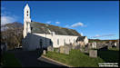
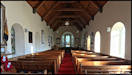
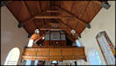
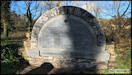
and folklore, but stopped on the way there for some shots of Kirk Christ,
the Rushen parish church.
DJI Mini 2 & Insta360
Ace Pro 26/2/24
29/2/24
Another aerial photography
expedition, this time to Port Erin, on Monday afternoon. I had a
specific target in mind that has a very interesting history, both in fact
and folklore, but stopped on the way there for some shots of Kirk Christ,
the Rushen parish church.
DJI Mini 2 & Insta360
Ace Pro 26/2/24
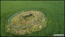
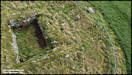
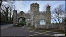
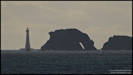
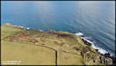
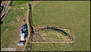
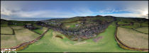
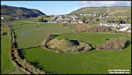
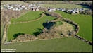
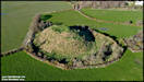
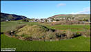
     The Fairy Hill
This was my main photography
target of the afternoon. I am amazed that in almost 34 years living
in the Isle of Man I don't think I'd ever even seen it! It has two
histories, the archaeological one is that it was probably a Motte &
Bailey castle. Introduced to Britain by the Normans, it consists
of a man made conical hill (the Motte) usually topped by a wooden defensive
structure (the Keep). The Bailey was an area at the base of the hill
enclosed by a wooden fence with a defensive ditch dug around it.
Most of the domestic buildings were here, including a hall, kitchen and
chapel. So why is it the 'Fairy Hill'? It comes from a Manx
fairy tale, the Silver Cup, where a cunning farmer stole a valuable drinking
cup from the Little People who lived in the hill and escaped with it to
Rushen Church. If you want to read the full story, it can be found
on line in 'Manx
Fairy Tails', scroll down the page to find 'The Silver Cup'.
DJI Mini 2 26/2/24
The Fairy Hill
This was my main photography
target of the afternoon. I am amazed that in almost 34 years living
in the Isle of Man I don't think I'd ever even seen it! It has two
histories, the archaeological one is that it was probably a Motte &
Bailey castle. Introduced to Britain by the Normans, it consists
of a man made conical hill (the Motte) usually topped by a wooden defensive
structure (the Keep). The Bailey was an area at the base of the hill
enclosed by a wooden fence with a defensive ditch dug around it.
Most of the domestic buildings were here, including a hall, kitchen and
chapel. So why is it the 'Fairy Hill'? It comes from a Manx
fairy tale, the Silver Cup, where a cunning farmer stole a valuable drinking
cup from the Little People who lived in the hill and escaped with it to
Rushen Church. If you want to read the full story, it can be found
on line in 'Manx
Fairy Tails', scroll down the page to find 'The Silver Cup'.
DJI Mini 2 26/2/24
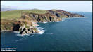
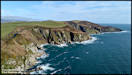
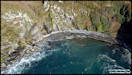
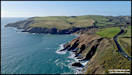
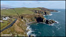
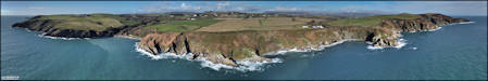
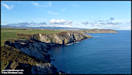
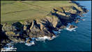
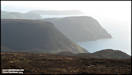
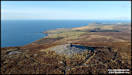
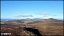
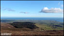
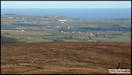
  1/3/24
On my drive home from
Port Erin via The Sloc, I decided that a brish walk up to the summit of
Cronk ny Arrey Laa might be nice, so parked the car up at the end of the
Eary Cushlin track and headed off with camera and drone. It's only
around a 300ft climb up and took me about 10 minutes.
Panasonic TZ60 &
DJI Mini 2 26/2/24
1/3/24
On my drive home from
Port Erin via The Sloc, I decided that a brish walk up to the summit of
Cronk ny Arrey Laa might be nice, so parked the car up at the end of the
Eary Cushlin track and headed off with camera and drone. It's only
around a 300ft climb up and took me about 10 minutes.
Panasonic TZ60 &
DJI Mini 2 26/2/24
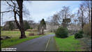
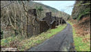
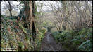
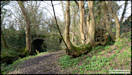
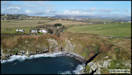
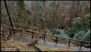
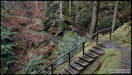
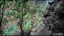
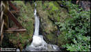
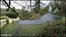
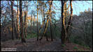
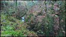
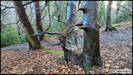
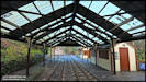
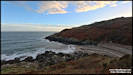
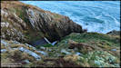
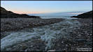
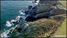
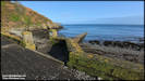
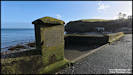
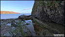
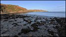
 On Tuesday afternoon
there were a few things I needed to do in Douglas, but as the weather was
nice and I had the time, I did a detour on the way home for a stroll around
Port Soderick and its glen. Compared to what it was in it's heyday,
Port Soderick has nothing much there these days, but is still a nice spot.
Insta360 Ace Pro 27/2/24
On Tuesday afternoon
there were a few things I needed to do in Douglas, but as the weather was
nice and I had the time, I did a detour on the way home for a stroll around
Port Soderick and its glen. Compared to what it was in it's heyday,
Port Soderick has nothing much there these days, but is still a nice spot.
Insta360 Ace Pro 27/2/24
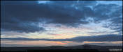
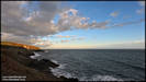
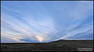
     Sunset from home on
the last day of the month.
Insta360 Ace Pro 29/2/24
Sunset from home on
the last day of the month.
Insta360 Ace Pro 29/2/24
|