|
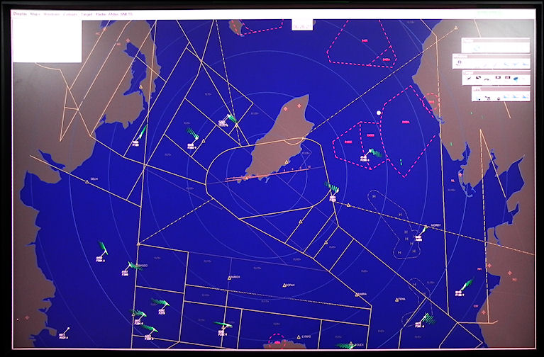
Ronaldsway
radar picture with weather and land returns filtered out. Mapping showing
the land areas, controlled and restricted airspace is overlaid with the
Primary & Secondary radar returns from aircraft. Circular 'Range Rings'
are selected for every 10 nautical miles.
|