|
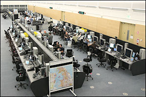
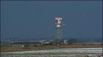
ATC is provided from
two locations, Aerodrome Control - located at the top of the 'stalk' and
Approach Radar Control,
located in the lower building. Air Traffic Control procedures are
governed by the UK Air Navigation Order, CAP 493 - The Manual of Air Traffic
Services Pt1 and the Manual of Air Traffic Services Pt 2 (Ronaldsway Airport)
|
Aerodrome Control
- Callsign 'Ronaldsway Tower' 118.9 Mhz
 The author presses the
'Crash Alarm' for the last time on September 7th 2014 (it was just a routine
practice callout)
The author presses the
'Crash Alarm' for the last time on September 7th 2014 (it was just a routine
practice callout)
Aerodrome Control has
authority over aircraft on and in the immediate vicinity of the airport
and vehicles on the Runways & Taxiways. Ronaldsway has two runways
available, giving a total of four possible landing and take-off directions,
they are designated according to the first two digits of their magnetic
directions, the longest runway is either 26 or 08 with the shorter cross-runway
21 or 03. ATC decide on the 'Runway in Use', based mainly on the wind direction
as aircraft performance is enhanced by operating into the wind, but also
other factors such as navigation aids available or in light winds the direction
traffic is arriving from or departing to. Pilots can request a non standard
runway and ATC will try to oblige, but it may not be possible as our aim
is to provide a 'safe, orderly and expeditious' flow of traffic and what
might be advantageous to one flight could result in delays to several others
and reduce overall expedition.
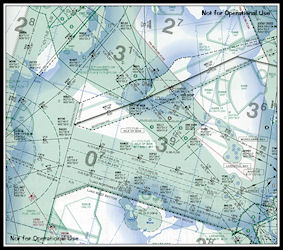
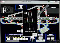
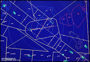
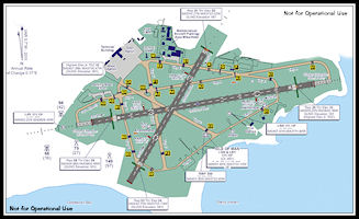 Ronaldsway Airport
Diagram - December 2011
Ronaldsway Airport
Diagram - December 2011
|
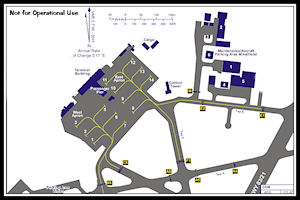 Ronaldsway Apron
Diagram - December 2011
Ronaldsway Apron
Diagram - December 2011
|
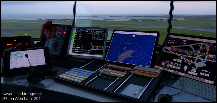
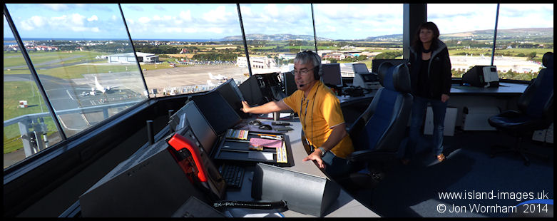
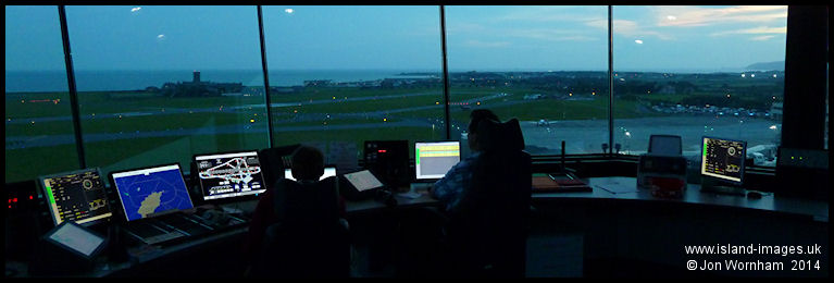
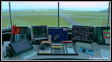 Aerodrome Controller
Workstation
Aerodrome Controller
Workstation
|
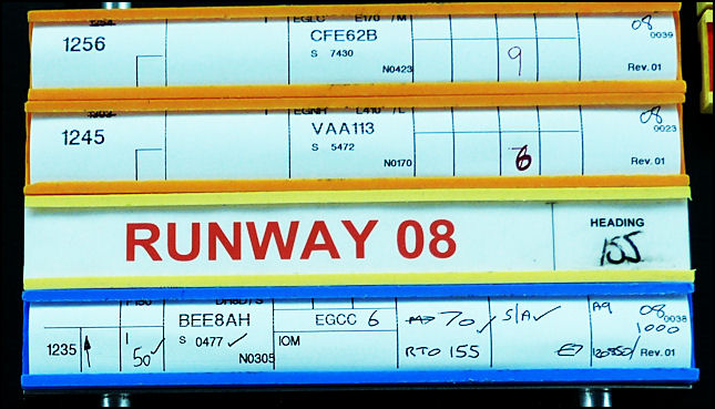
The tower controller
keeps track of aircraft and vehicle movements using a 'flight progress
board'. This holds paper flight progress strips in coloured holders
appropriate to the type of flight: Departures in blue holders, Arrivals
in yellow, Local flights (not landing away from Ronaldsway) in green and
Overflights in Red. Vehicles operating on the manoeuvring area have laminated
strips showing their radio callsign. All ATC instructions are recorded
on the strips which are moved around the board to indicate positions of
aircraft. A specific section of the board is used to show aircraft
or vehicles that have been allowed to enter the runway. To assist
the controller an Aerodrome Traffic Monitor shows radar derived information
of the traffic situation in the vicinity and to aid visual acquisition
of aircraft it is orientated 'south up' to replicate the controller's view..
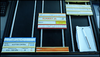 Tower Flight Progress
Board
Tower Flight Progress
Board
|
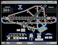
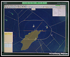 Aerodrome Traffic
Monitor (ATM)
Aerodrome Traffic
Monitor (ATM)
|
ATIS 123.875 MHz
Aerodrome Control is
where the ATIS - Automatic Terminal Information Service broadcast is prepared.
This is transmitted continuously using a computer generated 'voice'
when the airport is open and is routinely updated every 30 minutes.
It gives the runway in use, type of instrument approach to be expected,
latest weather report from Met and any other pertinent information on the
airfield or ATC operations. Each broadcast is identified by an incrementing
letter of the alphabet. Additional phrases can be recorded by ATC
if required.
Copperchase Flight
Data Management System (FDMS)
Integrating all the
ATC data together is the Copperchase Flight Data Management System. Flight
Plans are automatically received via the Aeronautical Fixed Telecommunication
Network (AFTN) and live estimates on inbound flights by phone from Scottish
Centre are entered to print paper Flight Progress Strips. Flight plans
filed directly with Ronaldsway ATC are entered into the system for dissemination
via the AFTN and Airways or local aircraft transponder codes (squawks)
entered. Weather information from the Ronaldsway Met Office is displayed
and relevant flight data is exported to the Park Air surveillance displays.
The main duties of the Air Traffic Service Assistants (ATSAs) are keeping
the FDMS up to date, by processing flight plans, inputting estimates and
logging arrival and departure times of aircraft to produce the computer
movement log book. FDMS terminals are located in both Aerodrome and Approach
Radar ATSA and ATCO working positions enabling data to be entered as required.
Ronaldsway Notices to Airmen (NOTAMs) giving pertenant information on changes
to published information are produced on the system for dissemination world-wide
via the UK NOTAM Office.
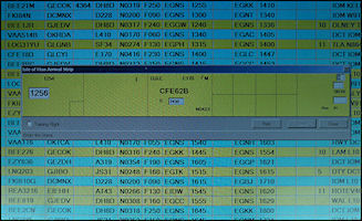
 FDMS Computer Terminal
|
 Inputting an inbound
estimate and squawk
Inputting an inbound
estimate and squawk
|
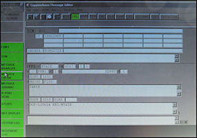 Message Editor Window
|
Arrivals
Inbound aircraft will
normally establish communications with tower when transferred by radar
at 10 miles or less from the airfield, either when they are established
on an instrument approach or visual with the airfield. There is normally
no telephone co-ordination required from radar so long as the ATM and SSR
is serviceable as the aircraft callsigns and landing order will be apparent
from the display. If there is any possibility of confusion, e.g. a slow
VFR light aircraft which will be overtaken by a faster IFR inbound, radar
will co-ordinate with tower to ensure that both parties have agreed a plan
of action.
Tower has absolute control
of the runways and will clear an aircraft to land once a preceding landing
aircraft has taxied clear of the runway or a departing aircraft is airborne.
Normally aircraft will receive a landing clearance by about 4 miles from
touchdown but it may be later if an aircraft is departing or a vehicle
crossing the runway. Once the aircraft has landed and slowed to taxiing
speed, instructions are issued to the parking stand, e.g. 'Jersey 8 Bravo
Golf, taxy to stand ten via bravo, alpha and foxtrot'.
Departures
Departing aircraft operating
under Instrument Flight Rules (IFR) will call tower before starting engines,
giving the ATIS information letter and are passed an 'airways' or
local clearance as appropriate. A typical 'airways' clearance would be:
'Jersey Eight Alpha Hotel is cleared to Manchester via (airway) Lima One
Zero. Climb Flight Level seven zero, after noise abatement turn right
(onto) heading one five five, squawk zero four seven seven. This
gives the pilot his initial departure clearance and he will read it back
to ATC for confirmation. Departures operating under Visual Flight
Rules (VFR) will normally make their first call after starting engine(s)
and be issued with a local clearance and squawk. As Ronaldsway is
situated in Class D controlled airspace, all flight require a flight plan
to be submitted to ATC before departure. Sometimes pilots will pass
this by radio after starting, but this inevitably results in some delay
to their flight as the plan has to entered into the computer system to
print a flight progress strip.
|
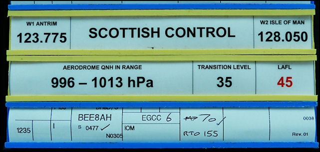
Initial Clearance
The clearance issued
to Jersey Eight Alpha Hotel (BEE8AH) has been recorded on the flight progress
strip, passed to the crew and read back - the ticks indicates that the
read back is correct.
|
|
When the flight has
completed boarding and is ready to go he will call tower again and be cleared
for 'push and start'. This authorizes engine start and for the aircraft
to be pushed back off stand by the tug, positioning onto the apron centreline.
As ATC has no responsibility or control over vehicles operating on
the Apron area, it is up to the ground crews to ensure that all vehicles
and other obstructions are clear before commencing the pushback. Smaller
aircraft, e.g. Let 410s may taxi directly off stand without being pushed
back first.
When engine start is
completed and the tug disconnected the pilot will call for taxy instructions
and if the route is clear a typical ATC response would be 'Jersey 8 alpha
hotel, runway 08 taxy to hold alpha nine via bravo, the QNH is 1021', which
the pilot will read back. All ATC instructions must be read back
for confirmation. The pilot will switch on the aircraft ATC transponder
with the issued 'squawk' code to show his position on ATC secondary surveillance
radars and taxi to the holding point. As the aircraft approaches
the holding point, the tower controller phones Ronaldsway radar and requests
a 'release'. This gives him permission to let the aircraft depart
in accordance with any instructions radar might issue. If there is
no conflicting traffic, the reply might be 'released to Scottish Control
on 133.050', i.e. the aircraft can depart in accordance with the clearance
already issued and be transferred directly to Scottish Centre on frequency
133.050. If there is conflicting traffic, the radar controller can
change the assigned heading or add a level restriction, e.g. 'Jersey 8AH
climb straight ahead after departure, released'. In this case the
tower controller passes the amended clearance to the pilot and obtains
a read back before instructing the aircraft 'Runaway zero eight, line up
and wait' and after again reading the instruction back the pilot taxies
the aircraft onto the runway.
|
Departure Co-ordination
The radar controller
has amended the initial clearance to instruct the aircraft to climb straight
ahead after departure which has been annotated on the strip, passed to
the pilot and read back (ticks by the instructions). The revised clearance
will be due to one or both of the inbound aircraft shown by the flight
progress strips above the runway designator as the flight paths are required
to cross at some point.
|
If there are no
other aircraft or vehicles on the runway the controller will then transmit
'Jersey 8 alpha hotel, runway 08 cleared for take-off' which will be read
back and the pilot will commence the take-off run. After the aircraft
is airborne and established in the climb, in this case probably passing
around 2000 ft, communications will be transferred to the appropriate departure
frequency: 'Jersey 8 alpha hotel, contact Ronaldsway radar, 120.850'.
Ground Movement
Control
Ground movements are
controlled to de-conflict aircraft and to optimize the departure order
of aircraft on the same route, aircraft being cleared to one of the designated
holding points or given clear instructions regarding other aircraft, e.g.
'follow the Stobart Air ATR to hold Alpha 9'. If a runway has to
be crossed while taxiing this must be specifically instructed, e.g.
'taxy to hold alpha one via foxtrot and alpha, cross runway two one' .
Vehicles are controlled
on the Manoeuvring Area using a discrete UHF frequency. 118.9 is re-broadcast
on this frequency so that vehicle drivers can be aware of aircraft movements.
ATC has no responsibility for vehicles operating on the airport Aprons
(aircraft parking areas). On the aprons, vehicles must use the designated
roadways and give way to all aircraft movements. Certain vehicles are permitted
to 'Free Range' on taxiways (but not runways) keeping well clear of all
aircraft movements.
|
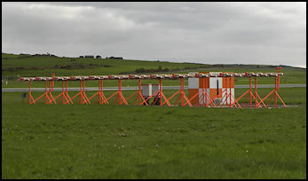
Runway and Taxiway
Lighting
During the hours of
darkness or in poor visibility the airfield runways are illuminated with
white lights and the taxiways with green centreline and blue edge lights.
These lights are all controlled from the Visual Control Room using a touchscreen
display. Taxiway holding points adjacent to runways are protected
by red 'Stop Bars', a row of red lights across the taxiway which aircraft
and vehicles are forbidden to cross. When the controller gives permission
to enter the runway, he deselects the stop bar on the lighting panel and
the green centreline lights continue onto the runway.
 Aerodrome Control
at Dusk
Aerodrome Control
at Dusk
|
|
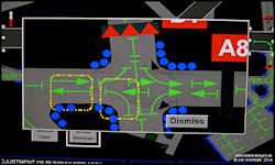 Aerodrome Lighting
Control Panel
Aerodrome Lighting
Control Panel
|
|
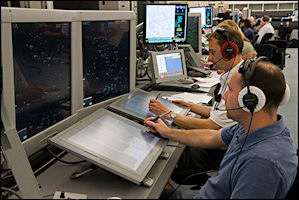
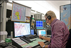
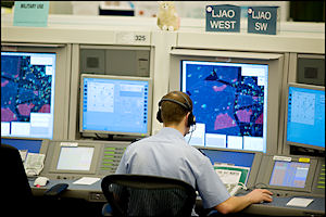
Approach Radar Control
'Ronaldsway Approach/Radar' 120.85 MHz & 118.2 MHz
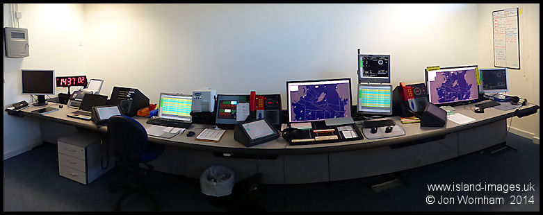 The Ronaldsway Approach
Radar desk - actually a straight desk, distortion caused by the panoramic
photo.
The Ronaldsway Approach
Radar desk - actually a straight desk, distortion caused by the panoramic
photo.
|
|
|
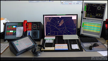
Approach Radar Controller
Workstation
|
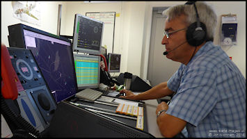
The author at work
in 'Radar 1'
|
Ronaldsway Approach
Radar usually controls aircraft up to about 40 miles from the airport.
Inbound traffic arriving via the Airways system is transferred from Scottish
Control, usually with no telephone co-ordination required, in accordance
with standing agreements that vary according to the route flown. Off-route
traffic will be identified and issued a clearance into controlled airspace
at a level under Ronaldsway's jurisdiction, that is at Flight Level 70
or below.
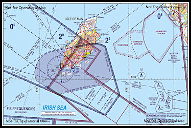
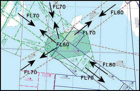
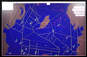
Northern Irish Sea
Airspace Maps
|
Agreed Levels
Under 'Standing Agreements'
with the Area Control Centre, inbound aircraft are descended by Scottish
Control and outbound aircraft climbed by Ronaldsway Radar to standard levels
as depicted. This ensures vertical separation with no co-ordination normally
required between units.
Airway 'Lima Ten' to
the southeast is worked as a one way system, aircraft positioned on radar
headings to keep inbounds on the north side and outbounds on the south
side.
|
Inbound aircraft flying
under the Instrument Flight Rules (IFR) are vectored (given headings to
steer and levels to fly at) using radar until they are established on an
appropriate Instrument Approach or wish to continue with a visual approach.
Separation is provided by ATC from other IFR aircraft either laterally
or vertically. The minimum separations allowed are 3 miles laterally
or 1000 ft vertically. They are then transferred to Tower.
Outbound Airways traffic
is worked by Ronaldsway Radar if there is a confliction with local traffic,
either inbound or overflying. Once the confliction is resolved the
aircraft is transferred to the relevant Scottish Control sector in accordance
with the standing agreement. Levels are assigned to keep aircraft
within controlled airspace and radar cover (to the north radar cover at
lower levels is restricted due to screening from the hills). Within
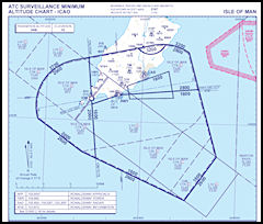
the Ronaldsway Control Zone, the minimum altitudes to be used are defined
by the 'ATC Surveillance Minimum Altitude Chart'
|
ATC Surveillance
Minimum Altitude Chart
Shows the lowest altitudes
that can be allocated by controller when vectoring aircraft
(Click for larger map)
|
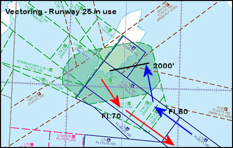
Two common ATC Scenarios
- vectoring aircraft arriving via airway L10 for an Instrument Landing
System Approach
Vectoring for
ILS Approach Runway 26
|
A significant proportion
of the airways traffic to Ronaldsway arrives via Lima Ten from the south
east direction. As the aircraft are already positioned by Area Control
on the north side of the airway, they are easily de-conflicted with outbound
traffic being routed by Ronaldsway to the south side of the airway.
The only problem that can occur is aircraft wanting to 'stay high' for
fuel conservation and having to be retained inside the confines of the
airway as the top of Ronaldsway's Control Zone only extends up to Flight
Level 65. MATS Pt1 instructs controllers that aircraft are to be retained
within Controlled Airspace if possible. |
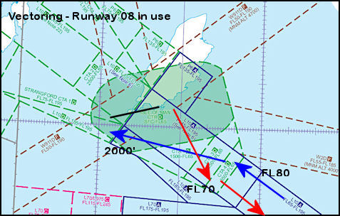
Vectoring for
ILS Approach Runway 08
|
Slightly more
complicated as the arriving traffic is still positioned by Area Control
on the north side of the airway and departures have to be positioned on
the south side due to a traffic orientation system involving the whole
route structure between England and Northern Ireland. At some point
the aircraft tracks have to be crossed and vertical separation must be
maintained until horizontal radar separation is obtained. Often not
helped by inbound aircraft wanting to maintain an optimum descent profile
(staying high) to save fuel. This can result in outbound aircraft effectively
being 'trapped' at lower levels. (And using more fuel!)
|
|
|
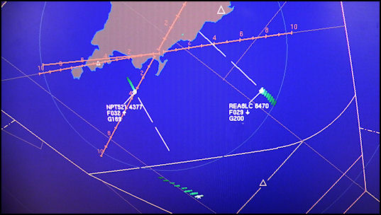
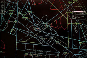
A close up view of the
surveillance display showing runway 26 in use. 'Aer Arran 8 Lima Charlie'
was being vectored to the ILS but has become visual with the airfield and
released for a visual approach (own navigation with no ATC level restrictions)
as it is horizontally separated from departure 'Neptune 521' which is being
vectored to the south side of the airway climbing to Flight Level 70.
|
|
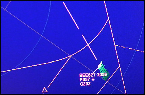
The green 'blips' on
the display are from the Primary Radar showing track history with a small
diamond symbol showing current position from the Secondary Surveillance
Radar. The aircraft data block shows the radio callsign 'Jersey 821' with
the SSR ATC Squawk code, 7026. The next line shows the current level
reported by the aircraft transponder, in this case Flight Level 57 with
the down arrow indicating that the aircraft is descending. The bottom line
shows the computed ground-speed, 232 Knots.
|
|
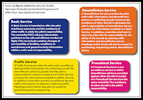
Air Traffic Services
Outside Controlled Airspace (ATSOCAS)
Although Ronaldsway
ATC is mainly concerned with aircraft operating within controlled airspace,
services are also provided to aircraft operating in uncontrolled (Class
G) airspace. Services available outside controlled airspace are either
'Basic Service', ''Traffic Service', 'Procedural Service' or 'Deconfliction
Service', which are defined in the Manual of Air Traffic Services and other
aeronautical publications.
ATSOCAS Services
Available
|
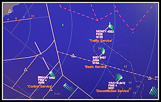
ATSOCAS Examples
|
Reduced Radar
Services
If either the Watchman
Primary radar (PSR) or Cossor Secondary radar (SSR) has to be taken out
of service, Ronaldsway can operate using the remaining system, but with
significant degradation to the service provided. If operating without SSR,
there are no aircraft labels on the display and aircraft identities have
to be remembered by the controller. Each aircraft has to be individually
identified before a radar service can be provided and as there is no height
information provided, many more radio transmissions are required to establish
vertical separations. All of the 'Standing Agreements' with Scottish Control
cease to exist so every inbound and outbound aircraft has to be co-ordinated
between Ronaldsway and Scottish. For aircraft operating outside controlled
airspace, there is also no height information on 'unknown' aircraft so
aircraft operating under a Deconfliction Service have to be vectored well
clear of any unidentified blip, even though the 'unknown' aircraft may
be flying 30,000 ft above Ronaldsway's traffic. The Short Tern Conflict
Alert (STCA) safety net is also unavailable without SSR.
 Ronaldsway Radar
- PSR Only
Ronaldsway Radar
- PSR Only
|
If using SSR only, only
aircraft with operating transponders will be shown on the controllers display.
Inside controlled airspace this is not a problem as transponders are mandatory,
but outside there may be aircraft flying without transponders or with transponders
not switched on for one reason or other. These aircraft are totally invisible
to the controller when operating using SSR only and pilots will be informed
of the 'reduced service - SSR only'
Approach Control
In the event of a complete
radar failure, Ronaldsway is able to offer a 'Procedural Approach' service,
providing separations based on time, level and distance in accordance with
MATS part 1. Although it is quite possible to work the airspace in this
way (and not unlike the service provided in 1937 in 'QBI') it is un-expeditious
and large delays are likely to build up in busy traffic situations, with
traffic being held both in the air and on the ground. The Flight Progress
Board becomes essential to the control of traffic, levels allocated to
aircraft being recorded as with radar control, but in addition many more
radio calls are required between ATC and aircraft to ascertain when levels
are vacated and can be allocated to another aircraft. Expected Approach
Times (EATs) are issued to inbound aircraft that have to hold, as a rule
of thumb when aircraft are making instrument approaches, one aircraft can
land every 10 minutes, providing that there are no conflicting departing
aircraft. Inbound aircraft may have to enter a holding pattern at a higher
level if there is a departing aircraft below. Once the departure is laterally
separated (time or distance) the inbound aircraft can be descended in the
hold to a suitable level to commence approach.
Instrument Approaches
Instrument
approaches are designed to allow an aircraft flying in Instrument Meteorological
Conditions (IMC) to become visual with the airfield and complete a landing.
Each Instrument Approach Procedure has defined minimum altitudes below
which an aircraft is not allowed to descend without visual contact with
the airfield. The Instrument Landing Systems are certificated to 'ILS Category
One' enabling instrument approaches down to a minimum altitude (runway
26) of around 200 feet (subject to pilot/company minima). At the specified
'Decision Height' pilots must be able to continue the approach visually
or commence a missed approach. Automatic landings are not permitted at
Ronaldsway.
Ronaldsway has instrument
approach procedures published for runways 03, 08 & 26. The main instrument
approaches used are the Instrument Landing Systems on runways 08 &
26. Both runways also have non-precision NDB/DME approaches and Surveillance
Radar Approaches available. Runway 08 also has a VOR/DME approach available,
using the en-route 'IOM' beacon to the west of the airfield. The only instrument
approach available to runway 03 is a Surveillance Radar Approach. There
are no instrument approaches available to runway 21, if required an instrument
approach can be made to another runway followed by visual manoeuvring to
land on runway 21.
CAA Approach Procedure
Charts
These give a pilot all
the information required to complete a instrument approach to land, including
the point at which the approach must be discontinued if the airfield is
not sighted. This varies according the aircraft category (based on size
& speed) and the approach type. Pilots will more normally use charts
produced by one of the big commercial companies, e.g. Aerad or Jeppesen.
Charts are published for every approach available, those below are just
a selection.
Aircraft operating at
Ronaldsway in 2014
For more Aircraft
from 2014 and earlier see my Aircraft
Pictures Web pages
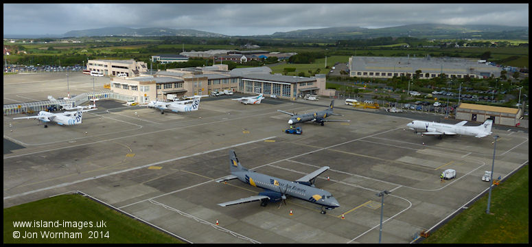
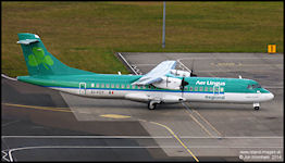
Scheduled Airlines
 FlyBe
FlyBe
|
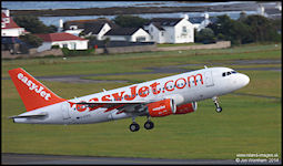 EasyJet
|
 Citywing
|
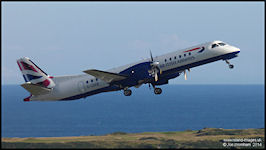 BA CityFlyer
|
 Stobart Air
|
 Atlantic Airlines
|
The Isle of Man
Aircraft Register
Aircraft registered
in the Isle of Man are regular visitors, often arriving direct from the
manufacturer for registration formalities, before continuing on to customers
around
the world. By Mid 2014
over 700 aircraft had been registered since 2007, using the prefix M-
 Bombardier Global
Express
Bombardier Global
Express
|
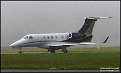 Embraer Phenom 300
|
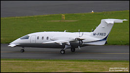 Piaggio Avanti
|
Military Flights
Ronaldsway is regularly
visited by military aircraft, most often the Hawk T1 & T2 jet trainers
from RAF Valley, usually for ILS training or practice diversions.
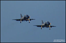 RAF Hawk T1 from
208 Sqn, Valley
RAF Hawk T1 from
208 Sqn, Valley
|
 RAF Tornado GR4 from
41 (R) Sqn at Coningsby
RAF Tornado GR4 from
41 (R) Sqn at Coningsby
|
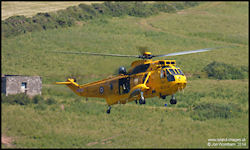 RAF Sea King from
22 Sqn, Valley
RAF Sea King from
22 Sqn, Valley
|
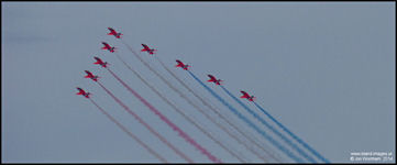 The RAF Red Arrows
|
 French Air Force
Xingu
French Air Force
Xingu
|
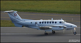 Swiss Air Force Super
King AIr
Swiss Air Force Super
King AIr
|
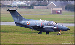
 French Navy Falcon
10
French Navy Falcon
10
|
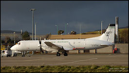
EAM and the ATP
Ronaldsway has long
had an association with the British Aerospace ATP, since Manx Airlines
started operating them in 1988. This continues today with aircraft
maintenance organisation European Aircraft Maintenance (IOM) carrying out
major servicing, mainly for Swedish operators West Air and NextJet.
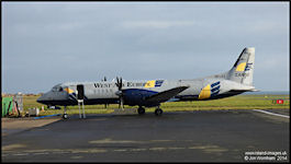 West Air ATP-F
|
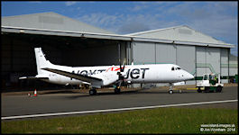 NextJet ATP
|
ATC Engineering
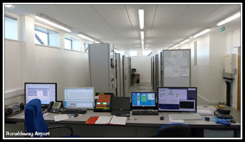
|
ATC engineering is a small
section of specialist engineers who keep all of the ATC technical equipment
operating. This ranges from the many computer systems used to radio beacons,
radio transmitters and receivers, instrument landing systems, radar and
radar display consoles and radio and radar recording systems. Whilst based
in the control tower, considerable amounts of equipment are located around
or away from the airfield. The picture shows the main equipment room in
the control tower. |
Navigation Aids used at
Ronaldsway
Ronaldsway is equipped
with a variety of radio navigation aids, to enable pilots flying in Instrument
Meteorological Conditions (IMC) to fly to a point where they can safely
complete a landing on one of the runways. These days the use of GPS is
becoming common for en-route navigation and airfield approach procedures
are published for some airfields in the UK. As yet, no such procedures
have been designed for Ronaldsway.
Aeronautical radio
beacons transmit an identification in morse code, usually two or three
letters. Pilots will listen to the beacon to ensure that they have tuned
the correct frequency although equipment on some modern aircraft can 'auto
tune' the beacon and display the identification visually on the flight
deck.
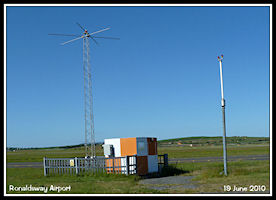
Non Directional
Beacon (NDB)
'RWY' 359 kHz
Wikipedia
NDB Article
Located on the airfield
the NDB is a basic Medium Frequency homing beacon, can be used for holding
and non precision instrument let down procedures. NDBs have been in use
for aircraft navigation since the 1930s and radiate a signal in all directions
(hence 'non-directional'). Automatic Direction Finding (ADF) equipment
in aircraft enable pilots to navigate to or from the beacon. The beacon
radiates on a continuous basis, even when the airport is closed.
Distance Measuring
Equipment (DME)
'I-RY or I-RH'
Wikipedia
DME Article
Located adjacent to
the 'RWY' NDB, DME
is a radar based system that provides aircraft with a distance from the
beacon. DME frequencies are paired with an associated VHF navigation aid,
in this case the Instrument Landing Systems on runways 26 & 08. The
airborne DME equipment is automatically tuned by the ILS/VOR equipment
and interrogates the ground beacon, receiving a reply pulse that enables
it to calculate and display the slant range to the beacon, which is displayed
in a digital format on the flight deck. This gives distances from touchdown
on either runway, being located equidistance from the runway thresholds.
The DME beacon codes according to the ILS system in use, but is also used
in conjunction with the NDB approaches and just to give a distance to the
airfield.
|
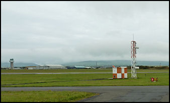
The mast on the left
of the picture with the 'hat' is the RWY Non Directional Beacon radiating
on 359 KHz.
On the right is the
vertical aerial for the airfield
Distance Measuring Equipment.
The orange and white
hut contains the beacon equipment.
|
|
Instrument Landing
Systems (ILS/DME)
I-RH & I-RY 111.15
Mhz DME CH48Y
Wikipedia
ILS Article
Precision instrument
approach aids installed for runways 08 & 26. Comprising a VHF Localizer
signal for horizontal guidance and a UHF Glideslope signal for vertical
guidance together with Distance Measuring Equipment giving range from touchdown.
The runway 08 Localizer is offset by 4 degrees to the north of the final
approach track, this was due to siting problems for the localizer aerial.
The usual location at the far end of the runway was not available and the
aerial had to be located to the south side of the runway.. Only one of
the two ILS systems can be radiating at any time and a complex interlocking
system is installed to facilitate changing from one to the other.
Offset ILS Localizer
Aerial - Runway 08
|
ILS Glidepath Aerial
- Runway 26
|
'IOM' VHF Omni
Directional Range with Distance Measuring Equipment (VOR/DME)
IOM 112.2 Mhz
DME CH59X
Located to the west
of Ronaldsway near Cregneash
Wikipedia
VOR Article
The 'IOM is an en-route
navigation aid operated by the UK National Air Traffic Services (NATS),
but also used by Ronaldsway
for holding and approach to runway 08
|
The aerials for the
co-located 'IOM' VOR & DME
The large circular aerial
is for the VOR with the vertical aerial for the DME above. Electronic equipment
is in the building below the aerial.
|
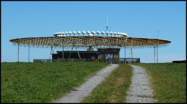
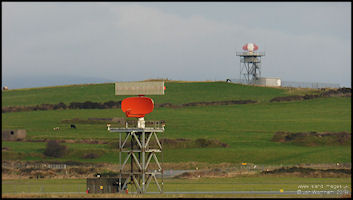
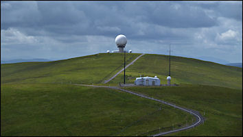
Watchman 10cm
S band Primary Surveillance Radar (PSR) & Cossor Secondary Surveillance
Radar (SSR) Mode A/C
Wikipedia
Article - Radar
Wikipedia
Article - Secondary Surveillance Radar
Providing surveillance
out to a range of 60nm, the radar is used for separation and tactical vectoring
of aircraft to a final approach aid. The watchman can also be used to conduct
Surveillance Radar Approaches (SRA) to runways 03, 08 & 26, the controller
giving headings to steer to maintain the final approach track to 2nm from
touchdown, together with advisory altitudes or heights. The radar aerials
are co-located on the same turning gear, with the SSR aerial mounted on
top of the PSR aerial. Primary radar works by detecting radar pulses reflected
from objects, generally aircraft but also ships, land surfaces and precipitation
and produces a 'blip' on the radar screen. Secondary radar works by interrogating
a transponder fitted to the aircraft and returns a discrete code (squawk)
and a height, which is displayed on the screen. Using the display processor
a particular code can be associated with an aircraft callsign to display
it on the controllers screen.
|
The co-located radar
aerials for the Watchman Primary Radar and Cossor Secondary Surveillance
Radar The PSR aerial is the lower solid dish type aerial with the
Large Vertical Aperture SSR aerial above.
Selex ATCR-33S PSR on
the hill behind
|
|
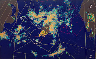 Radar showing 'uncancelled'
returns from weather and land areas in the IOM and England
Radar showing 'uncancelled'
returns from weather and land areas in the IOM and England
|
 A more normal picture
with and weather and land returns processed out.
A more normal picture
with and weather and land returns processed out.
|
Radar returns are shown
on Park Air situation displays, with the Watchman primary radar returns
shown as green 'blips' overlaid with the Cossor SSR labels. Aircraft
processed by the Copperchase FDMS system, e.g. all Ronaldsway inbound and
outbound aircraft, have the aircraft callsign and level displayed other
aircraft just show the ATC squawk code and level. The system computed
groundspeed can also be displayed as required by controllers. The
displays also provide 'Safety Nets', at the moment the only one in use
at Ronaldsway is Short Term Conflict Alert (STCA) - see above for a more
detailed description.
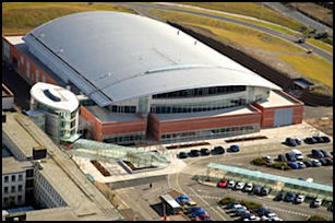
The Area Control Centres
London (Swanwick)
& Scottish (Prestwick) Centres operated by National Air Traffic Services
(NATS)
Air traffic control
services over a wider area around the British Isles are provided from the
two Area Control Centres, London ACC at Swanwick and Scottish ACC at Prestwick.
In the vicinity of the Isle of Man, most Area ATC is provided by Scottish
Control some by London Centre. Services are provided by both civil
and military controllers.
 Scottish Area Control
Centre
Scottish Area Control
Centre
|
 London Area Control
Centre
London Area Control
Centre
|
Scottish Control
Pictures courtesy of
and © NATS PC
Scottish controls en-route
aircraft operating within the controlled airspace structure over the northern
half of the UK
Sectors controlling
traffic in the vicinity of the Isle of Man are:
Antrim Sector 123.775,
Isle of Man Sector 133.050, Rathlin Sector 129.1
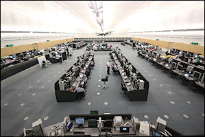 Scottish Prestwick
Centre Operations Room
Scottish Prestwick
Centre Operations Room
|
 Scottish Centre 'West
2' Group
Scottish Centre 'West
2' Group
|
Antrim Sector
controls Lima 10, Whiskey 911 Delta and Whiskey 928 Delta to the north
and east of the Isle of Man.
Isle of Man Sector
controls Lima
10 and and Whiskey 2 Delta to the south and east of the Isle of Man.
When 'bandboxed' (combined)
with Wallesey Sector uses 128.050.
Rathlin
Sector controls the high level routes over the Isle of Man and
as such has no direct interface with Ronaldsway.
 A Scottish sector
using Electronic Flight Progress Strips
A Scottish sector
using Electronic Flight Progress Strips
|
 Scottish Control
Surveillance Display picture
Scottish Control
Surveillance Display picture
|
NATS Radar Stations
covering the airspace surrounding the Isle of Man
 NATS Lowther Hill
Radar Station
NATS Lowther Hill
Radar Station
|
 NATS St Anne's radar
Station
NATS St Anne's radar
Station
|
Scottish Information
119.875
Scottish Information
provides a Flight Information and Alerting service to all aircraft that
require it to the north of the Isle of Man.
 Flight Information Service
Officer at NATS Prestwick Centre
Flight Information Service
Officer at NATS Prestwick Centre
|
London Control
London Information
125.475 London Volmet North 126.6
Most of the airspace
controlled by London has no direct interface with Ronaldsway, however to
the south of the Isle of Man a Flight Information Service is provided by
London Information. London Volmet provides
a continuous broadcast of weather reports for airfields, including Ronaldsway.
London Military
London Military 277.625
127.450
Provides a service to
the many military aircraft operating around the northern Irish Sea. Often
providing an Airways crossing service, one of their major customers are
the Hawk aircraft operating from RAF Valley on Anglesey, that need to cross
the controlled airspace over the Isle of Man before continuing with operating
over southern Scotland or the Lake District. Provides a radar service in
Air to Air refuelling Area 13 which is located just to the east of the
Isle of Man.
 London Military Sector
at Swanwick
London Military Sector
at Swanwick
|
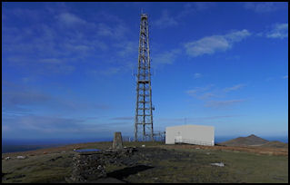
Snaefell Radio Station
Operated by NATS and
providing en-route ATC transmit and receive services for London & Scottish
Centres.
Located on the highest
point of the Isle of Man, accessed by the Snaefell Mountain Railway tramcars
or in Winter months by NATS own railcar
 NATS Snaefell Radio
Station
NATS Snaefell Radio
Station
|
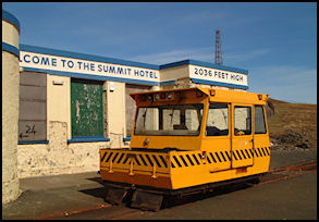 NATS Railcar
|
Listening to ATC
Radio
I should probably mention
at this point that despite what has been published in the past and the
general availability of radio scanners and publications detailing frequencies,
monitoring ATC communications is in fact illegal without proper authorization,
although as far as I am aware, nobody has been prosecuted for it and it
seems to generally accepted in the UK (and Isle of Man).
Ofcom publish guidance
here.
|